
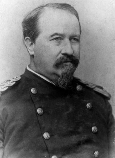
Major Clarence Dutton, around 1880.
Since it was Major Clarence Dutton’s 174th birthday yesterday, I thought I’d give him a nod for creating a simple geological concept that almost every geo-freshman finds impossibly confusing. Isostasy should be as easy to understand as a melting iceberg on a warm Arctic afternoon, yet I have seen so many students throw up (their hands) and whine that they just don’t get it.
The word isostasy was invented by Major Dutton who used isos (equal) and stasis (standstill) to describe the way less dense crust (such as continental) stays aloft, hoisting mountain peaks high above us, while denser crust (oceanic) lies low – yet each exerts equal pressure on the materials underlying the crust. In a future blog I will explain the concept with a couple of examples. Today, I want to write a rambling piece about the soldier who was once described by Pulitzerer Wallace Stegner as America’s Poet of the West and who became a renowned and innovative geologist.
As a child of the early 1850s, Dutton was indoctrinated with the conservative religion of the New England boarding school which his parents selected for him. At age 15, he entered Yale divinity college in preparation for life as a minister, but something rational happened to him there. It took just two weeks for Yale divinity school to transform him into a lifelong agnostic. Dutton left divinity school but stayed at Yale, transferring to chemistry and physics. He particularly liked gymnastics and chess, though literature seemed his most natural subject – he won the Yale Literary Prize in his last year at college, in 1860.
Major Dutton
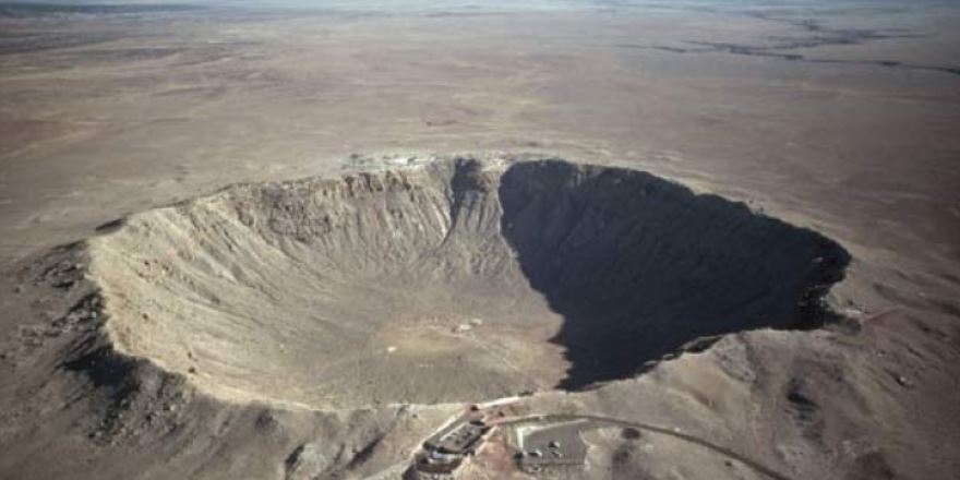
The War Between the States started shortly after his Yale graduation. Dutton enlisted and participated in nasty battles at Fredericksburg and Petersburg. He stayed in the Army after the war and then drifted, fully under-utilizing his recognized genius by simply taking mindless bureaucratic army posts – though he wrote a few significant papers in practical chemistry journals as a hobby. He was married, but not very ambitious – preferring to use his weekends drinking, puffing cigars, and debating science. After ten listless years, Dutton became best friends with the great American explorer John Wesley Powell who convinced Dutton to become a geologist. Major Dutton was soon one of the country’s best. He spent much of the rest of his life in the American West, exploring mountains, earthquakes, erosion patterns, and lava flows. The soldier from Connecticut was head of the United States Geological Survey’s Volcanic Geology Division – a role that placed him on volcanoes in California, Oregon, and Hawaii. His exploits included measuring the enormous depth of Crater Lake in Oregon and paddling down the Grand Canyon. Back east, he chaired a committee of like-minded geographers who formed the National Geographic Society.
Through his friendship with the explorer Powell, Dutton became expertly and intimately tied to the Grand Canyon, working on his geological study of the Colorado River and Grand Canyon area while he was a member of Powell’s survey. In 1882, he published The Tertiary History of the Grand Cañon District. His book was the first geological summary and atlas of the Grand Canyon and included this wonderful, colour woodcut made by artist William Holmes, under Dutton’s direction:

Dutton and Holmes, Panorama from Point Sublime, 1882
Dutton, after mapping the Grand Canyon and sounding the depths of the extinct Crater Lake volcano, turned to the study of earthquakes. He saw two possible causes: The world’s various earthquakes were either created by volcanoes or by who-knows-what – the latter being some unknown tectonic force. Dutton had a feeling that the restlessness of the Earth was related to a “layer of plasticity” beneath the planet’s thin crust. Although most geologists in the 1880s doubted the existence of such a fluid inner layer, Dutton felt so certain it existed that he wrote, “Reasoning or induction scarcely enters into it, it is substantially an observed fact.”
He suspected that this fluid layer was involved in the ever-shifting crust – building mountains, folding and shearing strata, and lifting or dropping masses of rock. He was nudging up close to the idea of plate tectonics a century before it was accepted science. He had a knack for creative critical thinking: Dutton also noted that earthquakes were thought to be a cause of mountain growth and faults in rocks. Dutton said the cause and effect were backwards – breaking rocks caused earthquakes; earthquakes were not the cause of broken rocks. “Just as thunder is an effect of the electric discharge, and not the cause of it,” he wrote.
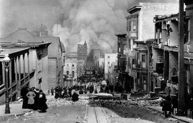
San Francisco, 1906
He was right, but at the time, it seemed that earthquakes, with their enormous destructive force, caused rocks to break and faults to appear. Quite obviously, earthquakes shear buildings and split streets. But Dutton was seeking the deeper cause, the force that actually generates earthquakes. This drive to understand the phenomenon really came to the country’s attention after the San Francisco earthquake. Geologists decided to map, measure, photograph, and trace all the faults they could in order to identify possible future dangers. Industrialist, robber baron, and philanthropist Andrew Carnegie stepped forward with cash for the Lawson Commission when government money didn’t materialize. The Commission’s goal was to try to understand and hopefully predict future events. From their studies, the geologists discovered that the San Francisco quake, and similar ones, occurred along pre-existing fault lines. They showed that the Earth’s crust slowly bends until it is suddenly returned to an undistorted position with the violent snap that creates an earthquake – exactly what Dutton had speculated.
Just before the 1906 San Francisco earthquake, Major Clarence Dutton wrote the best textbook about earthquakes up to his time. Dutton was a gifted writer and his book, Earthquakes in the Light of the New Seismology, does not disappoint. It reads like a novel and includes this passage about the earthquake experience:
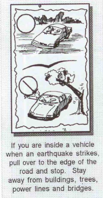
“When the great earthquake comes, it comes quickly and is quickly gone . . . a matter of seconds. . . The first sensation is a confused murmuring sound of a strange and even weird character. Almost simultaneously loose objects begin to tremble and chatter. Sometimes, almost in an instant, the sound becomes a roar, the chattering becomes a crashing. The rapid quiver grows into a rude, violent shaking of increasing amplitude. Everything beneath seems beaten with rapid blows. . . Loose objects begin to fly about . . . the shaking increases in violence. The floor begins to heave and rock like a boat on the waves. The plastering falls, the walls crack, the chimneys go crashing down, everything moves, heaves, tosses. Huge waves seem to rush under the foundation with the swiftness of a gale. . .”
Dutton continues this description until the house is gone. “Or,” says Dutton, “suppose we are out in the country and the earthquake comes suddenly upon us. The first sensation is sound, a strange murmur. Some liken it to the sighing of pine trees in the wind; others to the distant roar of the surf; others to the far-off rumble of the railway train; others to. . .” Well, you get the idea.
We celebrate Major Clarence Dutton. He was an engaging writer, intrepid explorer, and brilliant geologist – even if his legacy includes the difficult to digest idea of isostasy.


