The Age of Man?

Well, this is not the Age of Aquarius. Last week, geologists met in Berlin to discuss  renaming our current geological epoch – the Holocene. They say it began when the ice age ended, 11,700 years ago. The geologists in Berlin debated splitting the Holocene into two pieces. The most recent part would be renamed the Anthropocene – literally, the age of New (-cene) Man (anthropo-). There are some persuasive reasons to consider this change in nomenclature.

neanderthalOld Man, as we might call our distant ancestors, lived for 200,000 years in rather close commune with nature. Fire was tamed, stone tools were fashioned, animal skins served for warmth and perhaps modesty. But for most of those thousands of generations, the human animal population fit into the ecology with little impact and we numbered only a few hundred thousand. Our “carbon footprint” wasn’t much larger than a size 7 slipper. Then, around 8,000 years ago, New Man emerged. Agriculture and trips to the Moon soon followed. Progress in itself is not enough to warrant naming a new geological epoch for ourselves. Geologists base geological ages on more concrete entities. Distinct soils and rocks. Extinct animals. Changes in landforms and ocean chemistry. These have all identified past epoch transitions. Some geologists are arguing that New Man has modified the soil, killed some species, flooded a few islands, and added enough acid and carbon dioxide to the seas that we deserve having our name affixed to this altered stage of the planet. Congratulations to us.

In the past, the great ages of the Earth were divided into eras, periods, and epochs based largely on extinctions. When geologist Charles Lyell, in the mid-nineteenth century, named the major rock divisions (Paleozoic, Mesozoic, and Cenozoic) he and his colleagues distinguished them by their fossils. Those early geologists had no way of knowing the actual age of the formations – they guessed millions of years – but on the basis of the simple idea that younger rocks were in layers above older rocks, they worked out the relative ages. Fossil assemblages helped. Rather consistently, fossils occurring in deeper (older) rocks were simpler than the complex fossils found in shallower rocks. It was an early clue of evolution and astute geologists realized this years before Darwin explained the mechanisms involved.

Costa Rica’s golden toad – extinct in 1989.

Extinctions certainly formed the demarcation line between the time periods. Long before an asteroid was blamed for the transition between Cretaceous and Tertiary, geologists easily distinguished between the two. Cretaceous rocks hosted gigantic dinosaur bones while all the dinosaurs had vanished by the Tertiary. Similar stunning disappearances mark at least 5 other major time-boundaries. If extinctions were the only criterion designating the end of one age and the beginning of the next, then surely relabeling the most recent part of the Holocene as the Anthropocene makes sense – there have been many thousands of extinctions since New Man arrived on the scene. These famously include the dodo, golden toad, Yangtze River dolphin, passenger pigeon, and west African black rhino. There is good evidence human activity also ended the North American camel and perhaps the mastodon. These are the big photogenic creatures. There were also lesser animals that are no more. In a 1995 paper in Science, researchers showed that the extinction rate due to New Man’s activity is roughly 1,000 times greater than during the days of Old Man. There is, indeed, an Anthropocene extinction severe enough to show itself in the fossil record.

lima peruBut defining the Anthropocene entails more than tallying extinctions. In addition to disappearing species, previous geological eras and epochs stand out for their distinguishing rock types. New Man is busy creating some interesting geology. We might think that our most obvious monuments to ourselves – our steel and concrete cities – will speak grandly of our existence a million years hence. Probably not. Although in a few thousand years cities may crumble and leave tell-tale rust spots on the landscape, the besmirched soil will eventually erode. In most cases, signs of our cities will not last. Erosion sweeps away landscapes. Oceanscapes, however, are often preserved.

garbage
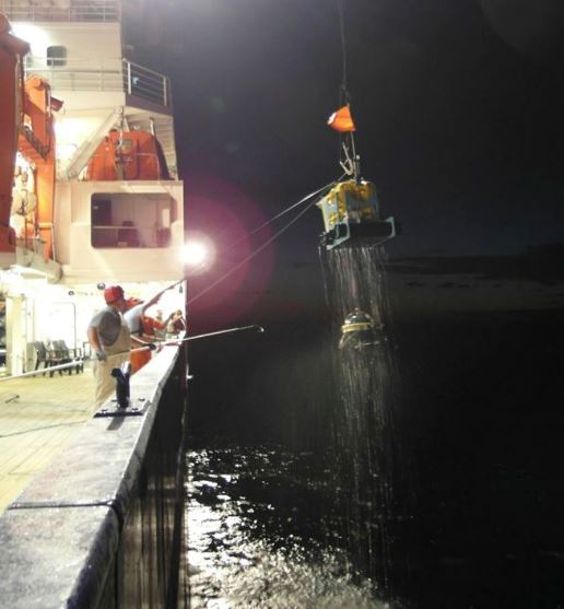
Therefore, the legacy of New Man’s Anthropocene may be most evident in places that seem obscure to us today. Although astute future geologist-creatures will find traces of radioactive dust as a sign of the mid-twentieth century (remnants of the fallout of atmospheric nuclear bomb tests) and future archaeologists may find landfills with non-degradable diapers and plastic hypodermic needles, it will be the seas that most clearly demonstrate the start of the Anthropocene.

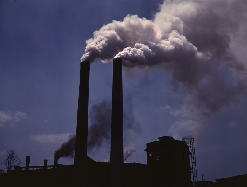
New Man’s brilliant ability to manipulate molecules into new chemicals has led to more effective fertilizers and pesticides. I am not opposed to these discoveries – our billions of human cousins need their bodies protected from malaria and malnutrition. We want a clean environment; but we can’t let people starve. But this not need to be an unsolvable dichotomy, a win-and-lose scenario, although we have mostly pointed our world towards a dead-end direction. Until we learn to curb our appetites for shiny bling-bling, we will raze our forests and ply the resulting fields with manufactured fertilizers and poisons. Modern chemistry is reshaping the soil (perhaps future geologists will notice the trace elements) but far worse is the damage to the basins into which our chemicals wash. It is in those basins – the world’s lakes, seas, and oceans – that the effects of the Anthropocene will remain the longest and be seen the most clearly.

Chemical runoff from fields and factories will unite with industrial aerial pollution, adding heavy muck to our seas. By the end of this century, enough carbon dioxide from the air will become mild carbolic acid in the oceans that the world’s coral reefs will die. The reefs will disappear as they have in each of the previous 5 major extinctions. Of course they may come back, as they have 5 times already. But there will be a million-year reef-gap and it will be associated with the human animal’s impact on the Earth.

pollution
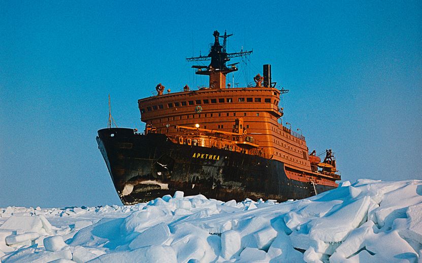
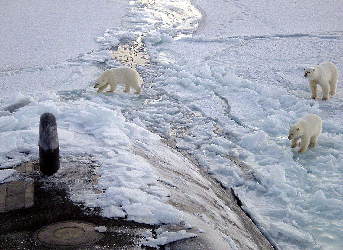
The billions of tonnes of coal and oil which New Man has converted to energy and carbon dioxide are melting polar ice, raising sea level and flooding shorelines. Neither pollution, climate change, nor the extinctions will mark an end to life on Earth. They might not even mark an end to man’s time on the planet. The Earth has been hotter and damper and colder and more violently altered in the past, yet life has endured – all of that roiling upheaval actually contributed to the rise of the human animal. But that does not excuse New Man’s messy creation of the Anthropocene.

Last week, geologists at the Berlin meeting pondered the formal use of this new name. The International Union of Geological Sciences’ Commission on Stratigraphy will decide in 2016 if Anthropocene will be approved as the officially designated appellation for the current epoch. If they approve,  the Age of New Man will be noted for a mass extinction of species, changed climate, flooded continental shelves – plus dabs of radioactive dust and a thin layer of Styrofoam coffee cups. These will document our existence on this planet.

Posted in Climate, Culture, Oceans, Philosophy | Tagged , , , , , , , , | 2 Comments

Russia’s Growing Pains

Up for grabs? North Pole web cam image from US NOAA.

Up for grabs? North Pole web cam image from US NOAA.

Russia plans to grow. It may do this by annexing 1.2 million square kilometres of Arctic Ocean. That’s a piece of Earth more than twice the current size of the Ukraine. This includes the North Pole. And potentially a lot of oil, gas, and minerals that other countries are claiming. Distressful news, to say the least. But it is not yet a done deal.

Here’s how the takeover could work. By international agreement, every country in the world is allowed to claim and completely dominate abutting ocean out to a distance of 200 nautical miles (370 kilometres). If this runs into a neighbour on the opposite side of a sea, the border meets in the middle. To exercise any control beyond that (in other words, to extend its maritime boundary into open, unclaimed seas), a country has to show that its continental shelf extends further than 370 kilometres. If it does, the country may claim the sea floor and any treasures below – but not the water column above. Sounds complicated, but if a country can show that its shelf goes on and on, it can claim subsurface minerals, oil, and gas indefinitely – but it can not stop marine traffic or fishing in the international waters above.

The United Nations granted the five countries encircling the Arctic Ocean a deadline to stake claims to the arctic. Last year, Canada produced geophysical and geological data that suggests Canada’s claim goes well beyond Canada’s Arctic Islands and extends up to the North Pole. It seems to be a valid claim, supported by oceanography data. However, this week, the Russian research vessel Akademik Fyodorov ended its surveys and the Russians immediately announced that their continental shelf also reaches the North Pole.

Apparently not needing to wait to analyze the new data, the Russian Minister of Natural Resources and Ecology (Sergey Donskoy) announced, “We lay our claim on 1.2 million square kilometers of the Arctic Ocean. That is a big increase to our country’s territory, that’s why we call this application an application for the future – an application for the future sustainable development of our country.”  This is according to the Russian news source Novosti. The Russian Ministry of Natural Resources will file its submission with the UN in the spring of 2015. By then, the Russian scientists should have had time to interpret the new raw data. But don’t expect the scientific results to differ from the political announcement already made.

Novosti says that Minister Donskoy called the North Pole research unique work. “Our main goal there was to conduct seismic exploration and we managed to achieve it. The seismic exploration of this kind was conducted for the first time in the world.” Not really. Marine seismic exploration and bathymetry surveys are hardly new nor unique – they have been around since the late 1930s and are no different than seismic data acquisition performed by the other four countries completing for a slice of high arctic resources – Canada, Denmark/Greenland, Norway, and the USA.

Arktika - the first surface ship to reach the North Pole - credit RIA Novosti, Commons

Arktika – the first surface ship to reach the North Pole – credit RIA Novosti, Commons

Ominously, the Russian military also takes a great (non-scientific) interest in the Arctic and that may ultimately decide the North Pole’s ownership. Russia will complete deployment of military units along the Arctic circle by the end of 2014, Defense Minister Sergei Shoigu said on Tuesday. This entails the establishment of 10 naval bases from Murmansk to Chukotka. “We have been very active in the Arctic region lately, and this year we will have a large number of units deployed along the Arctic circle,” Shoigu said.

The KV Svalbard, a Norwegian Coast Guard vessel. The Royal Canadian Navy plans to use this model to build half a dozen offshore patrol vessels at $4.3 billion each. Announced in 2007, none have been built, but Canadian Prime Minister Harper revealed in September 2014 that the first ship will be called the Harry DeWolf - if it is ever constructed.

The KV Svalbard, a Norwegian Coast Guard vessel, is the model for future $700 million Royal Canadian Navy patrol vessels. Announced in 2007, none have been built yet. But Canadian Prime Minister Harper revealed in September 2014 that the first ship will be called Harry DeWolf –                if it is ever constructed.

Canada, the second big player in the arctic waters, has done little to protect its interests. Seven years ago, Prime Minister Stephen Harper announced that an arctic training centre and deep water naval base would be built. One training base. That singular Resolute Bay base, announced with much bluster in 2007, finally opened last year. The proposed deep water port will be a resurrection of an old mining port at Nanisivik. A Nunavut military base was also announced in 2007, but construction hasn’t even started. “Canada’s very good at plans, but not so much at execution,” says Dr Rob Huebert, a University of Calgary professor, and arctic defence policy expert. Canada’s policy in the far north has been hesitant, to say the least. Currently, Canada has 150 soldiers protecting its four million square kilometres of arctic territory. Russia has thousands of troops along its expanse of arctic waters, stretching half-way around the entire planet – from Norway to Alaska.

The four non-Russian countries with an interest in the far north are all NATO members, so their combined presence could counterbalance the Russian occupation. There were even plans for joint Russian-NATO arctic exercises. But on October 20, Russian Foreign Minister Sergei Lavrov casually stated that NATO’s presence in the Arctic “was unnecessary.” There were no problems in the region, the foreign minister continued, that required NATO’s participation. Everything was working well in Russia’s capable hands. Back in April, President Vladimir Putin described a network of military facilities, warships and 13 aircraft bases as part of his plan to protect Russian interests and its territorial claims in the region. Relations are wary and Canada has been cautious – especially after Canada (which has the world’s largest diaspora population of Ukrainians) openly supported Ukraine’s Crimean claims. Russia retaliated by sending fighter planes over Canada’s arctic waters this summer.

US Navy submarine in the Arctic

US Navy submarine in the Arctic

You may wonder how the United States figures into all of this. Dr. Huebert, of Calgary’s School of Policy, calls the USA  “The Reluctant Arctic Power” and has written a policy paper with that title. He begins his study stating “the Arctic has seldom figured prominently in US policy.” The USA, of course, has a permanent Arctic presence through the state of Alaska and has long produced oil from the North Slope and Prudhoe Bay. But Huebert is right, the USA seems ambivalent to the opening arctic waters. While the United Nations asked the arctic countries to submit their territorial claims (Russia, Canada, Denmark, and Norway responded) the Americans ignored the filing deadlines. This could be because the American arctic frontier is only 1,000 kilometres long and holds little prospect of shelf-extension. In contrast, Canada has over 5,000 kilometres of arctic frontier and Russia has 7,000.

uscanadaborderWith respect to Canada, the Americans have sometimes been abrasive. There is a serious territorial dispute between Alaska and the Yukon regarding near-offshore waters. Canada claims the border continues northwest, perpendicular to the coastline while the USA disagrees and extends the border into Canada’s claimed zone. At stake is a Beaufort Sea resource play with millions of barrels of untapped oil. Further north, the Americans recently sent a nuclear submarine through passages between Canada’s archipelago of islands. Canada demanded advanced notice and a request for permission. None was sought. To save face, Prime Minister Harper quickly dispatched an ice cutter to “accompany” the Americans. Nevertheless, Harper’s best defense of the Canadian arctic frontier is not his 150 troops but a reliance on American help to push Russia back – if pushing is ever needed. Canada and the USA are, after all, friendly allies.

Last December, Canada was about to submit its own Arctic claim when Prime Minister Stephen Harper asked his science researchers to expand their results and include the North Pole.  The original Canadian claim didn’t include the North Pole, which lies near a large oil patch. But with prime-ministerial urging, the pole was added.  It sounds like a political add-on of the sort the Russians themselves pulled. The Canadian assertion, however, is not bogus and from the maps I have seen, has more scientific merit than the Russian counter-claim.

What is there to protect? Or take? Plenty. According to the United States Geological Survey, the arctic holds one-third of all the untapped oil and gas in the world. We don’t even know what other exotic delights (diamonds, gold, platinum, manganese, nickel?) await future explorers. The US Navy has concluded that global warming is real and that the Arctic will be ice-free each summer, likely starting in 2016. If true, this makes mineral and oil exploitation more tenable. And delivery of pumped crude by tanker ships will also be possible. Which brings us to the other strategic advantage belonging to the country owning the arctic waters.

The fabled Northwest Passage – sought since the days of Henry Hudson in 1610 – is the shipping route between Europe and Asia across the top of the globe. Until the Panama Canal was built in 1914, European freight traveled around the southern tip of either South America or Africa to reach Asia. A much more direct route links Europe and Japan, Korea, and China through the arctic. With global warming, the sea route is becoming feasible. In ten years, it will be the regular normal passage for most freight, according to the Council on Foreign Affairs.

The Russians tested a northern passage last year when an enormous empty liquified natural gas freighter – a tanker operated by Russian gas giant Gazprom – traveled from Japan to Europe (Hammerfest, Norway) where it was loaded with LNG. Accompanied by Russian nuclear-powered ice breakers, it then brought the liquified gas fuel back to Japan. The press largely missed this event, but it has phenomenal importance. It was the first commercial delivery of commercial cargo across that 6,000 kilometre stretch of the Arctic. The entire tanker journey (from Norway to Japan via Russia’s Northern Passage) was 11,000 kilometres. The alternative shipping route (from Norway to Japan via the Suez Canal) is 22,000 kilometres – if the tanker could squeeze through the canal – otherwise it would need to sail around Africa’s cape, a journey of 31,000 kilometres to Japan. The Russian route cuts a three-month trip to one month and saves hundreds of thousands of dollars in freight costs.

What is the science behind these territorial claims? International law bestows mineral riches to the countries that can show their nation’s continental shelf extends beyond the 370 kilometres of ocean normally given to a seafaring country. Continental shelf is determined in two main ways – the rock type on the sea floor and the depth of the water. In most passive margins, water meets land which slowly disappears as one ventures further asea. It is not unusual for shelves to extend several hundred kilometres with water as shallow as a few hundred metres. But almost everywhere, the land then suddenly plunges to the average sea floor depth of over 4,000 metres. It is well-nigh impossible for any country to claim that sort of a depth is a natural extension of a continental shelf. The average depth of the Arctic – the world’s shallowest ocean –  is only 1,050 metres. It is almost easy to confuse real continental shelf with real ocean sea floor on the basis of depth or topography. That’s why another determinant is useful. This is rock type. Continents (and shelves) are lighter weight rocks like granite and they rise above the asthenosphere. Ocean crust is heavier, basaltic rock. For a solid shelf-claim, rock samples are retrieved and they best not be basalt.

Russia has been using the extension of the Lomonsov ridge to booster its claims to the North Pole and much of the Arctic. The Russians say the ridge is an extension of the Eurasian continent. But the Lomonsov ridge is peculiar. It might not be shelf at all. Lomonsov is an 1,800 kilometre long ridge of narrow, uplifted continental crust. The rock type is continental. The ridge rises 3 kilometres above surrounding arctic water but is nevertheless rather deep, almost entirely lying under a kilometre of water. The Russians view it as an ancient craton – a chunk of exceedingly ancient continental crust that has survived the rifting, drifting, and merging of continental plates and has stayed attached to its tectonic host. But which host? Eurasian or North American? Therein lies the great debate.

The Arctic. Image from NOAA Commons.

The Lomonsov Ridge is near the centre, crosses the North Pole, and extends to Greenland. From this single view, it is seen terminating at the boundary between Greenland and Canada but is detached from Russia. Image from NOAA Commons.

The Russian scientists claim seismic data shows the craton is an extension of their continental shelf. But so do the Danes with seismic acquired by the Greenland and Denmark Geological Survey. I have worked with seismic data from the arctic, but not these two data sets. However, I can imagine it would be easy and convincing to extend the underlying shelf from either side. Seismic geophysics is a creative art. Cross-sections built from the Danish data (which I have seen) are persuasive and show the Lomonsov ridge rising to a relatively shallow height just north of Greenland.  The ridge’s attachment to either shelf and its tectonic history are vitally important to the UN decision.

Lomonsov might be a non-shelf crustal feature rather than an extension of a continental shelf – but, again, whose shelf? The ridge crosses confirmed Canadian territory, north of the Canadian Arctic Archipelago. Meanwhile, the Danes believe it is an extension of Greenland. All three – Russia, Canada, and Greenland/Denmark have laid claim to a vast swath of the sea – and the North Pole – much of it on the basis of the very odd (and ambiguously understood) Lomonsov ridge formation.

If Russia’s claims are rejected by the United Nations and no other country successfully claims the North Pole, it becomes a part of the Arctic called “The Area” which will be administered by the UN “on behalf of humanity as a whole.” But with Russia’s huge military presence in the north, a failed Russian scientific petition might not be enough to turn the North Pole over to international custody.

Posted in Exploration, Oceans | Tagged , , , , , , , , , , | 2 Comments

Pope Francis and the Magic Wand

Pope Francis at Vatican unveiling - October 27.

Pope Francis at Vatican unveiling – October 27.

Pope Francis has been in the news for the past few days. The pontiff has a habit of saying what he’s thinking and he sometimes does this at surprising venues. This time he was speaking at the unveiling of a bust of his predecessor, Benedict XVI. While there, the pope decided to share his thoughts about evolution, creation, and the Big Bang.

    “Evolution in nature is not inconsistent with the notion of creation, because evolution requires the creation of beings that evolve.”

It is not surprising that Francis would say this. The Church has accepted the science of evolution for 60 years. Pius XII said as much in the 1950s; in the 1990s, John Paul II said evolution was “more than a hypothesis” and was “effectively proven fact.” The Catholic Church has evolved a lot since the days of Inquisitions and the silencing of Galileo – today it favours science over superstition.

But what Francis said next was truly startling. He told the assembly that God is not a divine being or a spirit with a magic wand. Here are his own words:

    “When we read about Creation in Genesis, we run the risk of imagining God was a magician, with a magic wand able to do everything. But that is not so. . . God is not a divine being or a magician, but the Creator who brought everything to life.”

 So God does not do magic tricks for us. Of course the pope sees God as central to all Creation and Francis adheres to some unique specialness that humans have which is absent in all other forms of life. Although the Church clearly sees no conflict with the evolution of humans from primordial soup, the pope asserts that somewhere along the way souls were inserted into humans. This is a tough thing to reconcile. It implies that as life evolved there was once a generation (A million years ago? 60,000 years ago? 7,000 years ago?) in which some un-souled humans gave birth to some humans with souls. That’s a hard one to understand, although some members of the Catholic Church suggest that a unique couple – let’s call them Adam and Eve – were the first pair with souls and the rest of us were given souls (at conception) from that day onwards. Sorry, I am not a theologian so I can’t explain quite how that might work, but you can get an idea of the trouble this reasoning may create. But there is more that Pope Francis told us.

Also on Monday (October 27), Pope Francis had this to say about cosmology:

    “The Big Bang, which today we hold to be the origin of the world, does not contradict the intervention of the divine creator but, rather, requires it. . .

When Pope Francis says the Big Bang is held to be the origin of the world, he means that the Catholic Church accepts the cosmological statement of the Big Bang.  Something had to ignite the Big Bang that brought the universe into existence. That, says Francis, was God. This is hard to argue with. Hard to prove. But hard to disprove. After that moment, implies the pope, God put away his magic wand.

As a geophysicist, I find this very refreshing. When I think about the 40% of Americans who believe the Earth is less than 10,000 years old, it saddens me. It’s almost tragic that people who can microwave their food, ride elevators, sit inside aircraft, and tune into Fox with a remote, can also believe that little boys used to ride around on the backs of dinosaurs.

But then Pope Francis appears. I know, he’s not an American. (Not a North American, that is.) But he vocalizes the thoughts of the silent 60% of Americans who understand the workings of modern biology and geology – with its billions of years of slow steady changes. And that’s a good reason for me to keep writing about the Earth – knowing that there are people who are curious, alert, questioning, and thinking.

popefrancis

Posted in Culture, Philosophy, Religion, Science Education | Tagged , , , | Leave a comment

Shutting Down the Plumes?

Hot spot on La Réunion. Photo by Samuel Hoarau (Released to Creative Commons)

Hot spot on La Réunion. Photo by Samuel Hoarau (Released to Creative Commons)

Near an Indian Ocean island that regularly exhausts smoke and lava, a group of scientists are trying to unravel one of the great mysteries of the Earth. Their riddle involves the planet’s largest basalt field, dinosaur extinction, and the birth of Hawaii. The scientists are on a search to prove the existence of plumes – flares of magma that are presumed to rise up from deep within the mantle, break through hot spots, and build volcanic islands. Plumes are integral to the modern theory of the Earth and scientists have been searching for them for 50 years. They are hard to find. It might be because they don’t exist.

Plumes were first proposed by Canadian geophysicist Tuzo Wilson in the 1960s as a way to resolve some puzzling problems that threatened to sink the whole idea of plate tectonics. Tectonics was catching on fast at the time, but some scientists pointed out that according to tectonics theory, Hawaii and Yellowstone shouldn’t exist. Such volcanoes and hot springs shouldn’t be found so far from active, jostling plate edges. Plate boundaries were the action spots. They had heat from the friction of colliding and subducting masses of crust. But Tuzo Wilson had an idea, a vivid image that rose unexpectedly in his mind. He pictured a girl lying under water in a stream, blowing bubbles to the surface. The disturbing image showed him a way to think about the Hawaiian island chain. Wilson imagined that hot magma came up from a fixed point, or hot spot, as Pacific Ocean crust passed overhead. This solved the problem of anomalous volcanoes, but the idea was so peculiar at the time that Wilson – an established, respected, 55-year-old geophysicist – couldn’t get it published. His paper was finally accepted in the obscure Canadian Journal of Physics. Wilson said it was accepted there because the editors didn’t understand it and didn’t know it was controversial.

Soon after Tuzo Wilson’s paper appeared, a young American, Jason Morgan, detailed the concept and made it more substantial. Morgan had already made his name as the first person to really explain, mathematically, how plates could twist, turn, and move. He applied a 200-year-old theorem by the great mathematician Euler to determine plate motion. Then Morgan picked up Wilson’s work with plumes and made that idea more plausible. In 1971, Morgan identified 20 likely hot spots that he felt were related to upwards convecting mantle plumes. These included Hawaii and the Indian Ocean island of La Réunion.

For half a century, we have known that Hawaii exists because a plume of magma coming from the mantle built its islands. But do we really know this? Qin Cao at M.I.T. sees the island chain differently. She and her team believe they may have discovered a much more shallow source for the island lava fields. She thinks channels in the upper mantle are feeding Hawaii from a source a thousand kilometers to the west. Other researchers, notably Don Anderson of Caltech, are also questioning the theory. He says that new seismic data suggest narrow plumes don’t exist. It is Anderson’s idea that such narrow jets of streaming hot magma would defy basic physics, adding, “Mantle plumes have never had a sound physical or logical basis.” His research concludes that closely spaced seismic stations, new ideas about plume theory, and advanced computational methods reveal that there are no narrow, jet-like hot plumes. Instead, according to Anderson, there are thousand-kilometer-wide chunks of mantle slowly rising.

Retrieving a RHUM-RUM ocean-bottom seismometer in the Indian Ocean. Photo by permission of K. Sigloch.

Retrieving a RHUM-RUM ocean-bottom seismometer in the Indian Ocean. Photo by permission of K. Sigloch.

The new sets of seismic data that Anderson is talking about include data from work led by geophysicist Karin Sigloch in the south Indian Ocean.  She heads the German team on a joint French-German effort called RHUM-RUM (Réunion Hotspot and Upper Mantle – Réunions Unterer Mantel). The project placed 57 ocean-bottom seismometers in a huge patch around the island of  La Réunion. As Sigloch says, the goal was to “image an oceanic mantle plume – or lack of plume – from crust to core beneath La Réunion Island.” There was originally ample presumed evidence that a stationary plume, originating near the mantle, had erupted millions of years ago. As surface crust passed overhead, the plume was believed to have generated India’s vast Deccan basalt plains, contributed to the demise of the dinosaurs, and left a scar across the Indian Ocean that stretches back to La Réunion, near Madagascar, where the plume continues to smoke and eject lava. In October 2013, Sigloch’s group retrieved the seismometers that might prove (or disprove) this concept. They are processing and interpreting the data at this moment. Results are a few months away.

Jason Morgan, the geophysicist who refined plume theory from Tuzo Wilson’s eerie dream, is nearly 80. Last year he made a trip to the south Indian Ocean and sailed around the fiery island of La Réunion while Karin Sigloch and a new generation of geophysicists retrieved the seismic monitors that might prove the existence of his elusive plumes. Always the curious adventurer, he blogged from the research ship about observing the team’s research and he added that the Southern Cross was magnificent in the evening sky. How would he feel if Sigloch and her team found no plume? He would probably not be too disappointed. Jason Morgan had always regarded scientific truths as temporary truths. Forty years ago, shortly after he had described plate tectonic motion, he was asked what could he possibly do to make an even greater name for himself. “I don’t know,” said Morgan. “Prove it wrong, I guess.”

Posted in Exploration, History, How Geophysics Works | Tagged , , , , , , , , , | Leave a comment

Bad Russian Science

The Red Star of approval

The Red Star of approval

My daily Geo-calendar reminds me to consider events in the evolving history of Earth Sciences. Yesterday’s little blurb on that calendar commemorated the birth of Vladimir Belousov (1907-1990), the Soviet-era geologist who stopped plate tectonics, at least in his country. Having the ear of the politically powerful in an autocratic society magnifies the authority of one’s opinions. Even errant opinions.

Belousov was a member of the USSR Academy of Sciences and he organized the Laboratory of Tectonophysics. He was a well-place geophysicist. You might say his ideas regularly recieved the Red Star of approval. He successfully foiled Soviet advancements in geology for decades. Although acceptance of plate tectonics theory in North America stalled for 50 years after Wegener’s continental drift proposal, once scientists had the data and observations (in the mid-60s), the theory was very quickly incorporated into mainstream science.

But in Russia, thanks largely to Belousov and a few of his cronies, plate tectonics was rejected through the 60s and even the 70s, even with the new evidence in its favour. Belousov visualized stationary continents and ambiguously allowed them to rise and fall, but not drift. His 1942 theory of density differentiation (ie., heavy stuff sinks) was not groundbreaking science, but it became the Soviet de rigueur explanation of the way geology works on a global scale. Only vertical motion was possible. Because of this preferred and officially sanctioned theory, Soviet scientists delayed accepting the idea of plate tectonics. Belousov believed that the new western theory could not correctly explain his old vertical movements theory – hence, continental drift had to be wrong.

To me, Vladimir Belousov’s insistence that all new theories about the Earth had to fit within Soviet-sanctioned dogma is akin to the Intelligent Design/Creationist folks trying to fit all new scientific observations into the framework of pre-existing notions of how things should work. One can sustain the effort for a while, stretching and bending science to fit into an ever-less pliable mold (or simply rejecting bits of science that don’t fit the scheme), but eventually the whole thing snaps. One can play a Belousov role using autocratic authority for a while, but not forever.

Years ago, the Catholic Church – with networks of power and unyielding authority that the Soviets likely envied and emulated – attempted to freeze science with the cold water (and stretching racks) of brutal force. They forced Galileo to mutter that the Earth stands still in the sky while the sun moves around it. But no amount of bone crushing can stop human curiosity and the ultimate acceptance of testable scientific knowledge. It took hundreds of years, but the church in Rome apologized for some of its sins against science. The church became so enlightened that in 1996 Pope John Paul II said this about evolution:

“New knowledge has led to the recognition of the theory of evolution as more than a hypothesis.  It is indeed remarkable that this theory has been progressively accepted by researchers, following a series of discoveries in various fields of knowledge.  The convergence, neither sought nor fabricated, of the results of work that was conducted independently is in itself a significant argument in favor of the theory.” – Pope John Paul II

And so it is seen that religion need not always be at odds with science. But history has shown that ingrained, unyielding arrogance and conservatism of thought too often opposes free and unfettered inquiry. When troglodytic representatives of dogma gain power, the honest scientist has few safe options.  Belousov hindered geological science with arrogant assuredness that forced his underlings to contort plate tectonics theory or reject it. They rejected it. But in the end, when lasers and GPS made measurements of the actual incessant continental movement, the theory was confirmed and Belousov’s Stalin-era theory was dust-binned.

Posted in Culture, History, Non-drift Theories, Religion | Tagged , , , , , , | Leave a comment

David Suzuki and Popular Geology

David Suzuki, talking geology, we assume.

David Suzuki, talking geology, we assume.

David Suzuki makes some people cringe. These days, he is outspoken and sounds irritated, if not angry, about issues that matter to him – particularly the environment and Native rights. Dr Suzuki, a geneticist and entomologist, was arguably the world’s second most popular science guy back in the 1970s. (First place was Carl Sagan.) I watched Suzuki (I was a kid in those days.) whenever his Nature of Things appeared on the family tube. He taught this farm boy about nuclear energy, Lynx cats, genetics, and neutrinos. His topics became more controversial and included the downside of marijuana, genetic engineering, and last year’s story of his mother and Alzheimer’s disease. At age 78, Suzuki shows no signs of suffering from that illness; nor does he show signs that he is slowing down his incredibly energetic pace.

Suzuki still lives and works here in Canada, mostly for the CBC, but also at his NGO, the David Suzuki Foundation. But over at the CBC, he recently hosted a great series called Geologic Journey, a look at how North America was shaped by plate tectonics and subsequent geological activity – the Canadian Shield, Rockies, Great Lakes, and so on were each highlighted. The programs are regularly repeated and still hold an audience of geologists in their seats. But even Suzuki’s science-geology series managed to be controversial, simply because it is about the nature of ancient Earth – a world older than 6,000 years.

It still surprises me when I meet folks who want to argue for a young-aged Earth. A couple of nights ago, I ran into a kindly gentleman possibly of that conviction at a small gathering. Someone congratulated me on my latest book, The Mountain Mystery, and told me they were enjoying the read.

Nearby, the kindly gentleman asked what the book was about. “It’s a science-history book, about how people discovered the way mountains were formed,” someone said. “Did you know that just 50 years ago, we didn’t know for sure what caused mountains?” The gentleman was puzzled.

I can tell you how mountains were formed, ” he said. “Glaciers. Glaciers formed the mountains.” I interceded and explained that glaciers certainly shaped the mountains – causing cirques and arêtes, bowls and ridges – but mountain ranges rose through plate tectonics. “No, it was glaciers.” He seemed quite certain, and he is nice fellow, so I didn’t pursue the topic. I don’t know if he thought that all mountain-making had occurred in the past few hundred years or past few million years, but I didn’t ask.

It is as if there are two worlds of science:

  • In one world, the Earth revolves around the sun; in the other, the sun can be told to stand still in the sky (so that one’s enemies can be thoroughly slaughtered: Joshua 10:13).
  • In one world, inter-species breeding is a disaster, yielding sterile offspring such as mules at best; in the other, the sons of god took wives among the sons of man and bore giants as offspring (Genesis 6:1).
  • In one world, the Earth is clearly over four billion years old; in the other, it was created, as Bishop Ussher asserted, in the early evening before October 23, 4004 BC.

Of course, we no longer hear much about the stalled sun revolving around the Earth or the gigantic grandchildren of gods. But the Biblical story of the young Earth continues unabated.

Lately, however, I have seen a few refreshing websites and met a few thoughtful religious folks who tell me that they have no problem with the idea of a 4.3-billion-year-old Earth. I’ll point you to one such evangelist’s site: GeoChristian. I like that the website’s operator includes Geo in the name. I won’t try to speak for him – there are dozens and dozens of pages at GeoChristian that explain why belief and ignorance do not have to co-exist in the same body.

I began this piece with the much maligned David Suzuki. One does not need to agree with all of Suzuki’s contentions, but he certainly gives a person a lot to think about. And he has performed a great service by bringing science (and geology!) to centre stage in a colourful, provocative fashion. As he approaches his 80th year of discovery, we wish him continued success in awakening our thoughts to the miracles of the nature of things.

Posted in Culture, Religion | Tagged , | Leave a comment

Light on the Dark Side of the Moon

Did you see the blood red lunar eclipse? Wish I had, but here in Calgary we mostly had the undersides of clouds at 5 a.m. Pity. Poor us. But there are other eclipti coming. April and September 2015 should look good, although the long-term weather forecast is calling for continued clouds. Maybe the forecast will be wrong.

So we missed the eclipse. But it was an excuse to rise early and read up on lunar history. I learned that on this month (October 2014) just 55 years ago, no one had any idea what the dark side of the Moon looked like. It could have been green cheese – and you can bet that more than a few debunkers still believe it is.

The first image of the far side of the Moon, taken by Luna 3 in October, 1959.

The first image of the far side of the Moon, taken by Luna 3 in October, 1959.

But on October 4, 1959, a Soviet satellite exposed a roll of film (I know, it was one of those expensive digital cameras.) on the far side. The satellite sent back the fuzzy picture you see above. It looks grainy, but I am told that television wasn’t much better than this in the 50s. And it was sharp enough to allow the Russians to name most of the newly discovered features. Kondratyuk, Tsiolkovski, Volkov, Pavlov, Dobrovolskiy, and Shirakatski were some of the names on the larger craters and landmarks when the Russian Academy of Sciences released the first atlas of the Moon’s hidden side.

The far side of the Moon seems to be brie-free, but it is nevertheless decidedly different from the near side. The hidden lunar surface is much more crater pocked and has considerably more rugged terrain than the side that perennially faces Earth. The visible side has its great seas (about a third of what we see is maria, or lunar plains; only 1% of the distant surface has comparable features). The reason for the distinct difference is still debated, but seems linked to the way the Moon formed, which may have included an extra splat of another primordial satellite that fused itself to the lunar far side.

The far side of the Moon viewed in a more recent, sharper image.

The far side of the Moon viewed in a more recent, sharper image.

Posted in History, Space | Tagged , , | Leave a comment

The Geophysics Nobel Prize

Alfred Nobel, wondering who should get this year's Nobel Prize in Geophysics.

Alfred Nobel, wondering who should get this year’s     Nobel Prize in Geophysics.

Well, they did it again. That committee in Sweden announced all sorts of science prizes (and a lot of money, too) to pioneers in medicine, physics, chemistry, and even peace. OK, that last one isn’t a science prize, I think. But – once again – the good committee missed handing out a Geophysics Nobel Prize. Or one for geology, geography, oceanography, environmental science, or –  you’re with me aren’t you? What’s with that?

Granted, a Nobel Prize in Earth Science would not be greeted by the nerd-humor that accompanied this year’s Physics Award for inventing light emitting diodes, aka LEDs. Jokes like this one about the three discoverers who LED the way: “How many Nobel Prize winners does it take to change a light bulb?” – Three.

To whom does one award the prestigious prize in the geosciences? I wrote a bit about this in The Mountain Mystery . . .

. . . the plate tectonics model with its spreading seafloor, plunging trenches, colliding plates, and convection currents is the best general explanation for ocean basins, islands, continents, and mountains. Every geologist accepts there will be modifications of plumes, channels, blobs, megablobs, and things yet undiscovered that will rewrite this story. However, as Marcia McNutt, past president of the American Geophysical Union recently said, “The development of plate-tectonic theory certainly warrants a Nobel Prize. There is no doubt that it ranks as one of the top ten scientific accomplishments of the second half of the 20th Century.”

The Nobel committee does not honour earth science. No one will ever get the prize for showing us how mountains have formed. But if they did, to whom should the trophy go? Alfred Wegener is recognized for continental displacement, but Arthur Holmes showed the power source for moving the continents. And he proved that the Earth is billions of years old, not millions, allowing time for processes to occur. Alexander du Toit in South Africa bravely heaped evidence upon continental mobility. Marie Tharp and Bruce Heezen discovered the ocean rifts, Harry Hess said the seafloor spreads from those rifts, and Morley, Matthews, and Vine saw the magnetic striping that proved it all. Isacks, Oliver, and Sykes pointed out how the ocean crust is subducted and recycled. Jason Morgan and Xavier Le Pichon carved up the plates and used Euler’s laws to rotate them. Tuzo Wilson fixed a host of messy loose ends – finding plumes, transform faults, and cycles of ocean birth – and ocean death. It is our tendency to select a single figure as the symbol for progress and creativity, but none of these scientists worked in isolation. They all borrowed from Steno and Hutton and Lyell and Smith –  who in turn built upon the ideas of their predecessors. There are discoveries worthy of a dozen Nobel Prizes.

nobelprizex

Geophysicists need not apply.

Posted in Culture | Tagged , | 9 Comments

A Fast Trip through the Center of the Earth

Arriving in China.

Arriving in China.

When I was a child growing up in North American, I was told that if I dug a hole through the center of the Earth, I would emerge in downtown Beijing. (Or Peking, as it was known in English in those days.) Or somewhere in China. It’s a good thing I never got farther than a meter or so into the hole because, in truth, I would have ended up under water, in the south Indian Ocean. No responsible adult bothered to warn me about that.  I would have found myself about equidistant from Africa, Antarctica, and Australia –  and I would have been in big trouble without a raft.

My rabbit hole would have emerged at the bottom of the deep blue sea. In the ocean. Not in China. Recently, I decided to turn the question on its head, if you will, and see it from its upside-down perspective. Well, not exactly upside-down as China, like America, is in the northern hemisphere. Nevertheless, I am now considering the inverse question: if a child growing up in the 70s in China had the leisure to think about digging a hole through the center of the Earth, where would he expect to emerge? In my family’s Pennsylvania garden? No, not at all. The antipode (as the hole’s exit point is called) for Beijing is in southeast Argentina. Hopefully, that is what a Chinese child is told when he or she is flinging sod.

If you’d like to find your own personal antipode, there is a clever website that will show you the exact spot on a map. You can find it here.

One of my University of Saskatchewan geophysics professors asked this question on a mid-term exam: “What is the oscillation frequency of a ball dropped through a hole in the Earth that emerges at its opposite side? Assume the Earth is not rotating and ignore friction. You should also ignore the difficulty of actually drilling a hole through the center of the planet.” We were give ten minutes to derive the appropriate equations and calculate the answer. I’ll see if I can roughly explain the solution in less time, with less math.

I will try to work through this problem without using the formulas. This is partly to focus on the ideas involved instead of the numeracy – and it is partly because I have not figured out how to display math formulas in WordPress yet.

Standing on the Earth’s surface, we look down into the deep, deep, dark hole. Then we lean forward and release the ball. Goodbye ball. Because the Earth has stopped spinning (just to simplify this problem), we don’t have the issue of forward momentum (you, the ball, and the top of the hole would have been moving at almost 500 metres/second if the Earth hadn’t been halted) but near the center the velocity is near zero. So we don’t have the ball ricocheting off the sides of the hole as it falls. It just falls straight. And fall it does.

The released ball’s initial acceleration downwards is surface acceleration – 9.8 metres per second per second. You learned that number a long time ago. You might remember that the number changes with distance from the center of the Earth. As the ball falls, it approaches the core and acceleration gets smaller until the center is reached. At zero distance from the center, the acceleration due to gravity is also zero. But the ball is moving (at 7,900 metres per second). It has enough momentum to exactly carry it to the surface at the antipode.

gauchoIf you start this experiment in a car lot in downtown Beijing, the ball will emerge on the Argentine pampas amidst a herd of cattle. There the ball is stationary for an instant. But unless a deft gaúcho lassoes it, the ball will fall back down the hole, back through the Earth’s center, and return to you in Beijing. 84.5 minutes after you let it drop.

journeytocenterTo actually solve this problem, we have to recognize that the period of oscillation (i.e., one round-trip) is proportional to the Earth’s radius and Earth’s gravitational acceleration at the starting point. The radius is big (6,379,000 metres) and acceleration is 9.8 metres per second squared. To “unsquare” time, you take the square root (of the radius divided by acceleration). To solve for one complete period, or oscillation, you use the Earth’s unitless circumference, defined like any circumference in radians as 2 times pi. Fill in the numbers [2 pi times the square root of the radius divided be the acceleration], do the arithmetic, and you get a round trip of just over 84 minutes. Without the formulas and their derivations, these last three paragraphs were pretty awkward, weren’t they? (I can’t imagine how the Greeks and Romans did math without symbols.) If you want to see this explained in more detail and with the equations that I’ve omitted, there is a great explanation at this site:  Journey through the Center of the Earth.

Posted in How Geophysics Works | Tagged , | Leave a comment

The Bad Luck of Extinction

Bad genes or bad luck? That’s the subtitle of ExtinctionDavid Raup’s romp through Earth history from his viewpoint as a preeminent palaeontologist. Raup (along with colleague Jack Sepkoski) became somewhat well known for their theory that extinctions occur in 27-million-year cycles. He accompanied that theory with a related defense of the notion that the sun has a sister star, Nemesis, locked in a binary orbit but as yet undiscovered. In theory, Nemesis’s swing around the sun corresponded with mass extinctions by disturbing the orbit of comets and dwarf planets, which sometimes collided with Earth and caused massive die-offs.

I’ll save my thoughts about the death star Nemesis and Raup’s cyclicity of mass extinctions for a later story, except to say that Nemesis has never been proven. As more and more evidence has been uncovered, it seems less and less likely to exist. However, Raup’s hypothesis that extinctions are regularly occurring at 27-million-year intervals is seen as 99% likely, at least according to a paper from four years ago by Adrian Melott (University of Kansas) and Richard Bambach (Smithsonian Institution Museum of Natural History).

Rather than explore Nemesis and the cycles of extinction, I want to write a few words about David Raup’s 1992 book, Extinction: Bad Genes or Bad Luck. The book is almost 25 years old, but much of the science is still relevant and still (according to most palaeontologists) reasonably accurate. The book is extremely well-written, an easy read, accessible for non-scientists, and (at 200 pages) short enough for most people to finish on a single weekend. Raup, now retired and 81 years old, worked at the University of Chicago and was respected by the likes of Stephen Jay Gould, who wrote the book’s introduction.

One thing that drew me to read Raup’s book is the fact that it was written at the time that collisions of Earth with comets and asteroids was just beginning to be seen as the cause of mass extinctions. It is contemporaneous with the unfolding science of extinction. That alone makes it a valuable insight into the thought processes of players in scientific revolutions.

In 1980, the reformed nuclear physicist Louis Alvarez (et al.) presented the idea that dinosaur extinction 66 million years ago (the K-T, or Cretaceous-Tertiary mass extinction) was due to an asteroid’s impact with the Earth. The proof was a tenuous layer of iridium that marks the boundary between older Cretaceous rocks and younger Tertiary ones. Iridium is rare on our planet, but somewhat common in space rocks. The theory proposed that an iridium-rich meteor ripped into our world, heating and blasting the surface, and smearing its iridium around the world. Scientists have found it at the K-T boundary in New Zealand, Italy, and many points between.

In 1980, the idea that a meteor killed the dinosaurs was greeted with skepticism. Actually, “horror and disbelief” according to David Raup, who added, “It was like suggesting that the dinosaurs had been shot by little green men from a spaceship.” Raup was 60 years old when his book was released in 1992 and he retired shortly after. But he stood in favour of the notion of mass extinction via asteroid/comet impacts. This made him one of the first renowned palaeontologists to agree with the theory. Until then, many saw the idea of a rare catastrophic event as, well, horrific and unbelievable. Remember, geological gradualism held sway for two centuries. Darwin himself had rejected all catastrophic explanations for species extinction, writing:

“. . . we marvel when we hear of the extinction of an organic being; and as we do not see the cause, we invoke cataclysms to desolate the world, or invent laws on the duration of the forms of life! ” – Darwin, Origin of Species, p 73.

 Darwin saw extinction purely as a matter of a species losing its battle of survival of the most fit. He would not have conceded any deus ex machina role played by obliging comets. Darwin was probably wrong about this.

When I read Raup’s Extinction book, I was drawn to its center-piece theory because of parallels to the development of the theory of continental drift. My own book, The Mountain Mystery, tells the story of plate tectonics’ reluctant acceptance. Tectonics theory made the journey from pariah to popular about thirty years before the idea of mass extinction by falling rocks became a legitimate theory. With the tectonics hypothesis, scientists began with hesitant appeals to their colleagues – Harry Hess, a major advocate of seafloor spreading, first presented his idea as “geo-poetry” and offered his most famous paper (“History of Oceans“) in a rather tentative manner. (My book has an entire chapter called “Poetry in Motion” describing Hess’s creeping disclosure.) David Raup describes one of his first attempts to publicly promote the impact theory, in 1988:

“I presented a paper suggesting the universality of extinction by impact. The idea was apparently well received but largely because I labeled it a “thought experiment” and did not claim actually to believe it.” – David Raup, Extinction.

When Raup’s book was published, the Chicxulub Crater had just been discovered by petroleum geologists working in the Gulf of Mexico. Raup writes, “As I write this chapter in June of 1990, the scientific community is digesting two recent reports focusing on the Caribbean. One investigates a possible crater underlying the Yucatan, and the other describes rocks in Haiti that suggest deposition following a huge impact.” Raup continues:

“Perhaps within the next few months, it will be difficult to find anyone who ever doubted the impact-extinction link. That happened in the 1960s with the acceptance of plate tectonics and continental drift.” – David Raup, Extinction.

Posted in Book Review, History, Plate Tectonics | Tagged , , , , , , , , | Leave a comment