Created Last Thursday

Thursday

In business since last Thursday

It’s hard to argue with someone who says that the whole universe was created last Thursday.   Everything in its place, a stage built and actors entering. Is this the way you picture reality? I hope not – you would be deemed troubled and therapy would be offered. Your friends would hope for a speedy recovery. And yet, if you believed nearly the same thing – a fully intact universe aged 6,000 years – well, you just might get elected to the school board.

I thought about this when I read an awkward piece by a “young-Earth geophysicist” who clearly has a lot of explaining to do. To make all of the Earth’s physics fit into a half dozen millennia takes some clever scientific juggling. As a geophysicist, he was undoubtedly trained in geology and physics, especially things like radioactive decay, heat flow, and magnetism as they relate to the planet. A cornerstone of geophysics is continental mobility – formerly continental drift, now refined as plate tectonics. Few young-Earth geophysicists reject crustal movement because it has been measured with stakes in the ground. It is as hard to deny as a photograph of a hand in a cookie jar.

radioactive decayWhen we measure the age of rocks by calculating the amount of radioactive decay that has taken place, we prove that we live upon a very old planet. I will not review the definition of half-life nor describe how the various elements and isotopes transform. I discuss this elsewhere on these blog pages. You probably already know a good deal about it, but the key is that about ten different isotopes differently disintegrate into about ten other isotopes over periods varying from millions to billions of years. Because a variety of unrelated decaying materials transform at different paces, we have multiple, corroborating evidence that the world is over four billion years old. It is like having several photographers capturing the cookie jar hand from several angles.

To claim that the corroborating radioactive evidence pretends the Earth is 6,000 years old rather than several billion requires a complete suspension of physical laws. Some young-Earth geophysicists are quite happy to contort the data and tell us that in the recent past, radioactive decay happened very rapidly but it has slowed down in the past few hundred years. Others don’t mess with varying the decay rates, they simply claim that the universe was assembled with partially decayed assemblages of isotopes. In that case, the Earth could have been put together very recently. Last Thursday, in fact.

zebraAnother issue that makes the young-Earth geophysicist’s life difficult is the zebra-striped magnetic pattern on the ocean floor. As crust is created at spreading rifts, it cools and retains the orientation of the Earth’s ever-oscillating magnetic field. Because the embedded magnetism is either positive or negative, the variations are often depicted as black and white zebra stripes.

Correlating such things as radioactive decay, heat dissipation, and the age of fossils atop the blocks of parting oceanic crust (fossils near an oceanic rift are young; those farther away are increasingly older), geophysicists have calibrated the age of the magnetic pole reversals. Magnetic orientation switches every million years or so, meaning that the planet’s magnetic field also reverses direction at roughly million year intervals. But for the young-Earth model to work, the zebra-striping has to switch every few decades. Otherwise you can’t squeeze so many reversals into just 6,000 years. If you could, this would mean that many senior geophysicists have first-hand experience with global magnetic reversals. We don’t – trust me, we’d remember.

Consternating even more ruminations among the young-Earth geophysicists is the issue of moving continents. The average rate of crustal motion is about 2 or 3 centimetres (an inch) each year. We know this because we’ve measured it. Even young-Earth geophysicists agree with the evidence of split supercontinents and the Wilson Cycle of ocean basins. To claim that the Atlantic Ocean was built in fewer than 6,000 years,  such miscreant geophysicists require Europe and America to pull apart at a rate of about a kilometre a year, requiring phenomenally energetic mantle circulation. The amount of energy required to shift so much lithic material would generate enough heat to boil the oceans and melt the entire surface of the planet. After that, the crustal plates have to suddenly slow to 1/50,000 the speed to match what we observe today. And they would have to cool enough to support life. No wonder they call their idea Catastrophic Plate Tectonics.  It is hard to explain how 40-kilometre-thick slabs of continent could zip along, melting the Earth’s surface, then suddenly slow to a near standstill. Actually, it is impossible to explain. However, there is an easy solution – the universe was created last Thursday. It just looks much older.

Posted in Culture, How Geophysics Works, Non-drift Theories, Plate Tectonics, Religion | Tagged , , , , | Leave a comment

Smokers and Worms

A smoker's lifeU of Washington photo

Tube worms: a smoker’s life
U of Washington photo

If all life on the surface of the Earth died, who (or what) would mourn the loss? Not such a hypothetical question. A miscreant meteor could end our little party in a flash. But there is a rather good chance that deep, deep, deep below the waves life would carry on. In fact, about a thousand kilometres west of my laptop, hot volcanic smokers at the Juan de Fuca ridge are generating energy and nutrients for giant tube worms who may one day inherit the keys to our cottage.

This week we had explosive news about the latest eruption of a seamount which rises smack-dap atop Juan de Fuca’s spreading rift.  It’s the youngest piece of a long volcanic chain of bumps that stretches from Alaska’s Aleutians to the ocean floor off the Oregon coast. The seamount chain seems to be generated by a fixed ‘hot-spot’ which has been making a string of volcanoes for millions of years while ocean crust has passed overhead.

(Here we are talking about two different sorts of geology: rifts and hot spots. They do not normally coincide, but in this peculiar case, they do. Seamounts are conical volcanoes thought to be rising from hot spots; rifts are long narrow chasms that shove crust apart. It is a rare coincidence that the two occur at the same location, as they do at the tail end of the Cobb-Eickelberg Seamount chain.)

Geophysicists at the University of Washington were rather pleased that they could predict the Axial Seamount eruption. Their prognostication was based on the ebb and flow of pressure and the resulting inflation of the mount. When it reached critical parameters, the scientists predicted the blast and the volcano obliged. I am hoping that the spew doesn’t hurt our wormy cousins at the hydrothermal vents.

The deep-sea rift vents (and possibly the new conical volcano) are spewing steamy nutrients that could feed the Earth’s last great hope for survivors of Armageddon. The smokers, as some of the vents are called, are spewing super-heated water which, under pressure, is several hundred degrees hotter than neighbouring seawater. These geysers lift minerals, including sulfides that seem to be a favourite snack for some odd types of bacteria. The bacteria, in turn, are eaten by a variety of predators. An entire unique realm of life has developed in the blackness of the deep ocean bottom, far from sunlight and surface influences.

Black Smokers, off American west coast in the PacificUS Gov't photo: NSF

Black Smokers, off American west coast in the Pacific
US gov’t photo: NSF

The vents, geysers, and smokers were discovered in 1977. They create an amazing seascape. While most of the deep ocean is unnervingly quiet, the sea smokers are a haven for bizarre wildlife. An unmatched ecology exists there, totally disconnected from the sun’s energy. At such a depth, the Earth’s core itself is animating a realm entirely independent of the rest of us, providing life-sustaining energy. Among its bizarre creatures, the Pacific has giant tube worms, some as tall as an adult human. These live in superheated hydrosulphuric-laden water bubbling from the boiling sea geysers.

Rather than eating the bacteria thriving near the vents, about half of a tube worm’s weight is composed of those friendly microbes. In their symbiotic friendship, tube worms suck passing particles of hydrogen sulfide, carbon dioxide, and minerals from the hot vents and pass these as food to the bacteria adhering to their bodies. Lacking a digestive tract, the worm feeds the bacteria, then ingests the bacteria’s excreted organic material. The tube worm turns this into more tube, thus attracting more bacteria.

For us, there should be comfort in knowing that this distant and distinctly alien environment exists. We have no need to fear the total annihilation of all of Earth’s life. After being pelted by an asteroid, or suffering a cataclysmic volcanic event, our planet’s crust may melt, the atmosphere may evaporate, surface life may vanish. But two kilometres below the sea’s surface, giant tube worms will flourish undisturbed near the planet’s mid-ocean rifts. Life on Earth will continue. And on that cheery note, we bide you a good day!

Posted in Geology, Oceans | Tagged , , , | Leave a comment

Back to Katmandu

Barpak, Nepal - the day after the quake that killed thousands.

Barpak, Nepal – the day after the quake that killed thousands.

“The ATMs aren’t working. My cell phone gets a signal for just an hour a day – but I keep trying over and over again. When the battery runs out, I don’t know what I’ll do – there’s nowhere to charge it. And I don’t know where the rescue planes are.”

Thus are the lugubrious grumbles of a western thrill-seeker, a mountain climber, who is now begging for a plane to take him out of Nepal. He wants to get back to civilization. The yogists, trekkers, and climbers (some of whom paid $60,000 to be dragged up Mount Everest) were whining about the hardships they were facing and wondering why their embassy wasn’t getting them home.

I realize that it was the second day after the earthquake and richly spoiled westerners were in shock, saying things to the camera crew that they would have said differently if they had not been so shaken. But the theme was repeated again and again. They wanted to go home and they were dismayed that their government was not making it happen fast enough.  The Canadian government obliged. I saw a clip of Canadians seated on a huge Hercules cargo plane which had just been emptied of food and medical supplies. It was departing with home bound tourists and trekkers. These people were clutching their yoga mats and their hiking boots and getting a ride out.

To be fair, there were undoubtedly some visitors to Nepal who stayed to help. Some of those fleeing had small children and others had been injured. Some certainly couldn’t help. (I can imagine myself – in my wheelchair – manning a phone, perhaps, but otherwise being more of a liability than a help.) Nevertheless, some of those heading home were complaining that their holidays had been rudely interrupted. It is likely they didn’t understand the scale of the devastation that had struck Nepal.

There is the rubble of a thousand buildings that needs cleared and sifted for survivors and bodies. Over 6,000 people are dead. There are families to help. And there are a few volunteers who have arrived in Nepal with exactly these thoughts in their minds.

A Canadian in Nepal

A Canadian arriving  in Nepal

I’d like to note one person who dropped everything, rounded up as many medical supplies as her bags could hold, and raced from Montreal to Katmandu. Canadian JeanetteWithout a sponsor, without wads of cash, with no NGO leading the way, Jeanette left Canada as quickly as she could. She is now in the village of Lanagol, Nepal, doing what she can.

She is in a bit of a different position – a paramedic by training, she had been to Nepal in the past as a visitor. Since then, she had returned a few times to teach emergency medical care. There was no question in her mind that she needed to go to Nepal quickly.

You can see her story here.

Posted in Culture | Tagged , | Leave a comment

The Man on the Moon

Eugene Shoemaker is the only man on the moon. It’s his birthday, he would be 87 today, but he won’t know it. Shoemaker has been dead for almost twenty years. His ashes have been on the moon since 1997.

Shoemaker-Levy comet impacting Jupiter. Hubble Space Telescope image.

Shoemaker-Levy comet impacting Jupiter.
Hubble Space Telescope image.

Unless you are a bit of a space junkie, you likely never heard of Shoemaker. He taught geology to Apollo astronauts (so they’d know which moon rocks to bring home) and, along with his wife Carolyn and their friend David Levy, he co-discovered the Shoemaker-Levy comet that spectacularly plunged into Jupiter back in 1994, to the great delight of amateur stargazers with scopes focused on the red planet. It was the first observed celestial impact and it informed us greatly about what happens when comets crash into Jupiters.

Shoemaker’s father was a Nebraska farmer; his mother taught school. Shoemaker earned his unusual astrogeology PhD at Princeton in 1960 and the next year he founded the Astrogeology Research Program for the U.S. Geological Survey.  Within a couple of years he caught the attention of Scientific American and wrote a piece (The Geology of the Moon) for them in 1964. It included this justification for the study of astrogeology:

“We expect that the study of lunar geology will help to answer some longstanding questions about the early evolution of the earth. The moon and the earth are essentially a two-planet system, and the two bodies are probably closely related in origin. In this connection the moon is of special interest because its surface has not been subjected to the erosion by running water that has helped to shape the earth’s surface.”
– Shoemaker, 1964

In Arizona, Gene Shoemaker led astronauts around Meteor Crater and Sunset Crater, giving the space cadets some crater experience. During the lunar Apollo missions, he moonlighted on the air with Walter Cronkite’s CBS news coverage, giving stellar commentary.

Meteor Crater in Arizona: an Apollo training ground

Meteor Crater in Arizona: an Apollo training ground

Eugene Shoemaker

Eugene Shoemaker 1928-1997

Shoemaker was a relent- less investigator. He traveled the world looking for pieces of other worlds – meteorites that might cede clues about the stony landscapes that reside overhead.

He also restlessly pursued craters on the Earth – such impacts led to his analysis of microscopically unique shocked quartz (coesite) and the craters helped him understand the mechanics and products of impact collisions.  It was a trip to Australia at age 69 that found him driving a car across the desert northwest of Alice Springs with his wife. He was seeking yet another crater to examine. On a forlorn stretch of a rutted trail, he rambled along at 80 kilometres an hour, hugging the safe smooth center of the road. He met another vehicle, approaching from the opposite direction. The Australian driver approaching him pulled hard to the left to miss Shoemaker’s car. Unfortunately, Eugene Shoemaker was an American driver – at the same instant, he veered sharply right to avoid a collision, which caused him to crash head-on into the other vehicle. He died; his wife was badly injured.

Almost exactly two years later, on July 31, 1999, his ashes were carried to the moon by the Lunar Prospector space probe. Shoemaker is the only person whose ashes have been placed on the moon – he remains our only man on the moon.

Posted in Biography, Exploration, Geology, History, People, Space | Tagged , , , , , | 2 Comments

Katmandown

Katmandu’s earthquake was a tragic surprise; but not unexpected. Katmandu sits atop a fault that releases pressure as continental crust merges. India, which was an island until 25 million years ago, continues shoving itself into Asia. This sparring of continents cost at least 3,400 lives this weekend when the pressure of the grinding plates was released in a 7.8 magnitude earthquake. The incessant south Asia continental clashing has built the Earth’s grandest mountain range – the Himalayas. This time, tectonic force lifted and dropped Katmandu 3 metres (10 feet!) south of where it was a week earlier. The quake ripped a gash along the surface stretching over 100 kilometres from its shallow epicentre. All of this happened in less than 90 seconds.

Katmandu temple: 2014, left; 2015, right

Katmandu temple: 2014, left; 2015, right

Lamjung, Nepal.

Lamjung, Nepal. (Photo by Bishwo Ghimire)

In Nepal’s capital, Katmandu, temples and shrines were destroyed, apartment blocks were leveled, and most of the several thousand deaths in Nepal occurred there. The earthquake, however was centered about 100 kilometres west, near Lamjung, an alpine farming district. Most recovery and emergency operations have focused on the more populated capital, so it is not known how desperate things are for people who live in Lamjung, atop the epicentre. Another site garnering attention is, of course, Mount Everest. It is even farther away from the quake centre (about 220 km), but it has name recognition – and among the 18 known deaths at Everest are westerners, most of whom were there for the sport of climbing the mountain. Avalanches caused by the earthquake caused the deaths at the Everest base camps; these have been heavily covered by the sometimes myopic western news media.

http://geohaz.org/news/images/publications/KathmanduEarthquakeScenario.pdf

Excerpt from Geohazards International handbook for Katmandu earthquake preparation.

This earthquake was certainly expected, though the exact moment of its arrival could not be foreseen. A few years ago, the non-profit Geohazards International had published a lengthy document, Katmandu Earthquake Scenario, which predicted in painful detail the events unfolding today in Nepal. The charity organization assesses geophysical hazards around the world and it ranked the Katmandu Valley highest among its “risk per capita” stats. Their 32-page booklet was generated to prepare people for the inevitable. It is a powerful read, written in simple English, and it walks us through a moment-by-moment encounter with a potential Katmandu earthquake.  On impact, “school children are crouched under their desks, waiting for instructions from their teachers. Doctors and nurses are helping the most seriously ill patients to protect themselves and are preparing to evacuate the hospitals. Drivers in automobiles pull carefully off to the side of the road, waiting for the shaking to stop. . .” The document gives practical advice, encourages drills and exercises, and follows through the next hour, day, week, month, and year describing what victims should expect after a major Katmandu earthquake. The report discusses medical aid, water, food, electricity, and psychological recovery related to the survival of those affected. If you are thinking you should help, consider a donation to Geohazards International – they seem a worthy outfit. In fact, they have people in Nepal who were already assessing hospitals just hours after the earthquake struck.

Meanwhile, the recovery enters its third day. Poorly built structures (many apartments had unreinforced cement and weak masonry) and the disrupted water and electricity are continuing to take their toll.  At 7.8, this was the largest magnitude earthquake the area has experienced in 80 years and aftershocks as large as 6.7 (also severely destructive) are continuing. Katmandu will recover and rebuild – we hope that the new construction will be designed to withstand similar earthquakes. And we hope that drills and emergency exercises will continue to be part of daily life for the Nepalese. Such practice saved a few lives last week, it will be even more helpful in the future.

Map prepared by Geohazards International, using US Geological Survey information.

This map, prepared by Geohazards International, using US Geological Survey data, indicates the Katmandu Valley was most severely hit. Epicentre is shown centre-left and Mount Everest is top-right on this map.
Follow this link for a larger-scale map.

.

.

Posted in Geology, Plate Tectonics | Tagged , , , , , | Leave a comment

Sit on a continent, go for a ride.

My continent moves at a nail's pace. This is what it did since 2009.

My continent moves at a nail’s pace.
This is what it did since 2009.

Of course you know about plate tectonics. Sit on a continent, go for a ride. You were probably told in grade school that continents move with as much speed (and unstoppable determination) as your fingernails are supposed to grow. That’s more-or-less true, unless we use the East Pacific Rise Plate as our model – it moves much faster and that would imply that you have wicked claws. The average speed  for continental motion is two centimetres per year, but you could get dizzy riding the East Pacific Rise –  every two years it moves the width of a charter airplane seat.

These motions are not all smooth sailing. On some parts of the planet, sudden jerks result in horrendous earthquakes. The mid-sized Nazca Plate is grinding itself under South America at a rate over 8 centimetres a year. Its movements are not steady. These are not the progressions of plodding oxen, but rather the leaps of a kangaroo. Sometimes the abrupt jumps are astonishing. I narrowly missed experiencing a violent three-metre crustal leap during the 2010 Chilean earthquake. Near the epicentre, the town of Concepción moved the length of a car in a single lurch as one tectonic plate climbed over another. Now that it has jerked ten feet, it will probably not move again for 50 years. Elsewhere (Iceland, for example) the ground is fairly steadily ripping apart. The place has volcanoes (Eyjafjallajökull kept me in central Europe for a week in 2010 when all flights home were grounded.), but Iceland has few serious earthquakes. However, the island nation is simply  slowly ripping apart.

Plate Motion Table  I thought it would be interesting to see how my part of the world is creeping along under the power of plate tectonics. I found a plate-motion-calculator on this UNAVCO site.

UNAVCO describes itself as a non-profit, university-run “consortium that facilitates geoscience research and education”. Until today, I had not heard of them. They seem to provide massive quantities of GPS-measured plate motion data. You can download huge files collected from around the world and use them to make your own discoveries.

On the page at the end of this link, you will find a rather complicated-looking form that lets you type in your latitude, longitude, elevation and much, much more. There are actually 25 fields in which you may enter data, but I ignored almost all of them. You can see in the image above that I simply input my Calgary latitude and longitude (51 N and 114 W, which needs entered as minus 114 to designate the western hemisphere). The database returned the drift of my house. Calgary seems to be averaging 1.940 cm/year, in a southwestern direction. This is slower than most places on the planet, which surely explains why Calgary is famous for its lack of vertigo epidemics. The velocity from UNAVCO’s website is shown to you in a table, or in a download file, if you prefer. You can see my results here:

Calgary Plate MotionI ran the program again, using Vancouver’s location. Vancouver, about 700 kilometres west of us, had an almost identical result: heading southwest at 1.993 cm/year. Vancouver is apparently outrunning Calgary at a rate of half a millimetre per year. Not much chance of western North America ripping apart somewhere along the TransCanada Highway within my lifetime. However, I did a third measurement, 200 kilometres west of Vancouver and found quite different values. The ocean floor beneath the Pacific (the Juan de Fuca Plate), just off Vancouver Island, is approaching Vancouver at 2 cm/year, heading precisely northeast. This, of course, is already well known and amply documented and it explains earthquakes along the famous west coast subduction zone. Yesterday, in fact, a 6.1 magnitude quake shook the Haida Gwaii region, just north of Vancouver Island.

I hope you have time to enter your hometown’s location and some of your favourite cities. I input a few more: New York City, northwest at 1.52 cm/year; London northeast at 2.47 cm; Tokyo northeast at 2.92; Kolkata northeast at 5.52; Beijing east-southeast at 2.96 cm/year. By the way, if you enter locations on the African plate (say, Cape Town, for example), you get zero motion. Not that Africa is exempt from plate tectonics – it is moving, of course. But all the preceding motions are with respect to Africa – geophysicists general choose to use that continent as the reference. Hope you take a few minutes to discover your own continental motion.

Arrows indicate plate movement with respect to the African Plate.

Arrows indicate plate movement with respect to the African Plate.

Posted in Geology, Plate Tectonics | Tagged , , , , | 1 Comment

Curse of the Petrified Tree Trunks

hillbilly carSummer driving season is creeping up on us and the world’s national parks want to again warn visitors that removing protected rocks and artifacts can get you into big trouble. With the government, of course. But even worse, you may find yourself in deep doo-doo with the spirit world.  People regularly have really bad luck after they’ve stolen rocks from public places. It’s a world-wide phenomenon with hundreds of stories of disease, disaster, and financial ruin befalling tourists who have brought back special (and very cheap) souvenirs from Hawaii, Australia, the Vatican, and Arizona, among other places.

A recent book, Bad Luck, Hot Rocks, printed by the artsie publisher The Ice Plant, uses stunning pictures of stolen petrified tree trunks to document the misfortune and regret that besets visitors to Arizona’s Petrified Forest if they exit the park with illegal ballast in their boots. Judging from letters reprinted in the book, people have written annoyingly contrite confessions to the National Park Service – and sent back the stolen loot. “My wife left me and the dog died within months,” writes one felon-in-training in a typical note accompanying a fist-sized bit of smokey quartz and sparkly amethyst tree bark fossil.

Arizona's Petrified Logs

Some of Arizona’s Petrified Logs

The park has accumulated a small pyramid of returned pieces of their 200-million-year-old stoned forest. They dubbed the prodigal stones The Conscience Pile. Unfortunately, once a rock is stolen, taken home to New Jersey, then returned via the US Postal Service, the rocks are useless to the park. They can’t be carted back into the petrified forest – an artifact of any sort looses most of its value the moment it is callously dislodged. So the arrivals are stashed atop that conscience pile of stoners. Likely, though, the streams of bad luck haunting the thieves is stanched as soon as the rocks are riding postal planes back to the desert. That’s usually the reason for surrendering the goods. Some people realize they were wrong and made a mistake by stealing the bit of ancient Americana, but most returns are made in an attempt to alleviate self-inflicted bad karma.

Arizona Red Wood

Arizona Red Wood

The Petrified Forest People have claimed that 12 tonnes of petrified tree are pilfered each year. I doubt the amount is that large. If the average theft is two kilos, that would mean six thousand people take illicit souvenirs annually. I refuse to believe there are that many dishonest people in the USA. Neither does the parks service, I guess, because they have recently reduced their estimate of the amount of petrified tree trunk that is stolen. However, they continue with random checks of cars exiting the national park and they enforce a heavy fine against any apprehended ne’er-do-wells.

Elsewhere in the States, Hawaii has also been targeted by sacrilegious thugs. The goddess Pele is deeply offended if people scoop up black beach sand or pumice that she has violently coughed up over the past million years. You see, she believes that every grain of her exhausted magma is one of her children. In response to the wanton kidnapping, Pele sends evil spirits after the plunderers.

The folks running one Hawaiian website offer to ceremoniously return materials pilfered from Pele. The site runs a priestly confessional booth. Follow that link to see the innumerable tragedies that have cursed the existence of hapless souvenir collectors. Here is an example from their site (and remember, this could be you!):

Please return these stones to Pele. We’re very sorry that we took them and should have realized the mistake before we left the island. Shortly after we got back to California, I got a cold which is still with me even more than five weeks later. Also, I hurt my shoulder while working out, and my television blew up, and a 100GB hard drive on my computer (which is less than a year old) just died today. I’m doubtful that the hard drive can be repaired, and there is a great deal of data on it which cannot be replaced. I was planning to return the stones myself next year, but given the current rate of bad luck, I’m not sure I’ll be alive that long. Anyway, please express our apologies to the Goddess. I even had a dream the night after we took the stones, and I think that maybe she was trying to warn me not to leave the island with them, but like an idiot, I misinterpreted it. It didn’t occur to me what we’d done until after we’d already gotten back and the bad luck started to happen. In any case, thank you for this service. J.V., San Bernadino, CA.

Similar tales of woo and woe originate from Uluru, the rock briefly known as Ayer’s, in Australia. Many locals believe it is a holy rock, but invading sun-burnt visitors pound grappling hooks into the monolith, hoist themselves up to photo-op positions, and chip off souvenir chunks of red sandstone. Such heathen tourists are followed home by relentless spirits who proceed to destroy the offender’s lives. Again, horrific tales of stuffed sinuses, lost loves, and dead pets abound.

Einstein's tongueOn a rather different level, I think that the most gutsy klept of an unusual souvenir was Einstein’s brain, lifted from the great man’s head the day after he died. The pathologist at Princeton Medical Center took it without permission (but later received an unenthusiastic approval from Einstein’s son). The unfortunate physician hoped he could study the brain, discover the secret to brilliance, and publish a relatively special paper. Instead, Dr Thomas Harvey lost his job, lost his marriage, spent his retirement years working in a plastics factory, and ended up keeping the segmented neural mass of the century’s smartest scientist in mason jars in his Kansas home. Further, Harvey had a dwindling supply of gray matter – he occasionally sliced off slivers of Einstein’s brain on a wooden chopping block with his kitchen knife and doled them out to esteemed visitors. Don’t believe me?  There’s video.

What’s with these vengeance-seeking ghosts that hex and curse? It may have something to do with the way humans link causes to effects. We tend to congratulate ourselves for our successes, but look for some obvious scapegoat for life’s little failures. If we’ve found a perfect mate, earned a big promotion, or landed a great contract, we don’t attribute such success to a lucky piece of petrified wood stolen a few years earlier. But when things go painfully wrong, we know without doubt it wasn’t us – it was that stupid bit of fossil tree trunk in the kitchen junk drawer that did it. This is classic post hoc ergo propter hoc fallacy, and we all fall for its comforting logic from time to time.

By now you know the risks and can make up your own mind about what to do with your fingers while you are visiting a shrine. If you decide to go the cheap souvenir route and are flying home, for God’s sake, mail the rocks – don’t carry them on the plane with you. If you already have a stolen rock in your possession and things have been going poorly, you can apply logic and recognize it as a coincidence. Or maybe the only safe and decent thing is to give the cursed rock to that university that rejected your entrance application years ago. Or just fashion it into jewelry and send it to the ex-lover who dumped you shortly after you brought the souvenir home.

Posted in Culture, Geology, Religion | Tagged , , , , , | Leave a comment

A Life Well-Lived

Lawrence Morley, left, with pilot Fred DuVernet in front of the Geological Survey of Canada's aeromag collection plane, around 1952. (Image used with permission of the GSC)

Lawrence Morley, left, with pilot Fred DuVernet in front of the Geological Survey of Canada’s aeromag data-collection plane, around 1952. (Image used with permission of the GSC)

Two years ago this week, one of our greatest scientists quietly passed away. Although among the world’s unheralded heroes, the life of Lawrence Morley deserves our attention. He helped prove plate tectonics, but in a fluke too common in science publishing, the brain prize went to a lucky Cambridge grad student instead. The story of his paper’s rejection by Nature makes as bitter a tale as any you will find in the history of science.

To know Morley’s story, we need to go back to 1960, when Alfred Wegener’s much maligned theory of continental drift was getting a facelift. Wegener’s idea that continents “plow through” oceanic crust had been scientifically faulted for over 40 years – there were no scars trailing the continents as they scratched their way through ocean crust and there was no known power source strong enough to do the job. However, overwhelming evidence from paleoclimate and fossil distribution insisted that continents must move.

Iceland's Silfra Rift: North America, left, Europe, right. (Image credit: Davido69 Flickr http://www.flickr.com/photos/davido69/

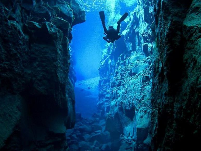
Iceland’s Silfra Rift: North America, left, Europe, right. (Image credit: Davido69 Flickr)

Continental drift evolved into plate tectonics between 1958 and 1968. It was a fascinating ten years. Geophysics was the engine of discovery. Heat patterns on the seafloor (hottest near the newly discovered mid-oceanic rifts) and magnetic patterns that mirrored each other across those rifts were key evidence that continents move. Heat was fairly easy to measure and understand. This played a part in 1962 paper by Princeton’s Harry Hess. Dr Hess suggested that the mid-ocean rifts were splitting the seafloor, widening it and pushing the continents apart. Rather than drifting, the continents were on a slowly moving conveyor belt. Hot magma oozed out at the rifts, separated, and cooled as it got further from the center. Temperature data confirmed the idea. Professor Hess was eminently respected, a brilliant geophysicist. Yet he cautiously dubbed his revolutionary paper  geopoetry and it was ridiculed by the stubborn majority anti-drift crowd. The heat distribution was a coincidence, they said.

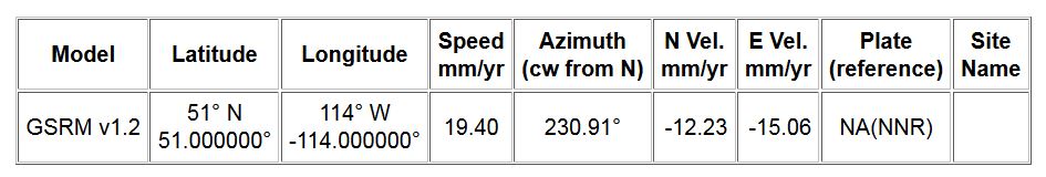
But soon an entirely independent set of data was interpreted to support Hess’s seafloor spreading theory. An industrious Brit, Ron Mason, attached himself to a US Navy research ship which was mapping the depths of the Pacific. The Navy was searching hiding places that might conceal enemy cold war spy submarines. Mason convinced the Navy that dragging a magnetometer behind their ship would yield some useful information. They agreed, but the raw data – gathered over a two year period in the 1950s – was deemed classified. However, Mason was allowed to publish an edited map of the results. It became known as the zebra-stripe map. Ron Mason could not explain the odd pattern.

Magnetic zebra-pattern, acquired along US-Canada west coast, 1957. (Image by permission of Geological Society of America)

Magnetic zebra-pattern, acquired along US-Canada west coast, 1957. (Image by permission of Geological Society of America)

Some of the geophysicists who studied the 1957 map (published in 1961 by the Geological Society of America and reprinted here with their permission) proposed that the stripes were due to a weird distribution of magnetic minerals in the seafloor. Others suggested that Mason’s editing and processing caused data artifacts. But the Canadian Lawrence Morley noted that alternating reversed polarity from  the Earth’s magnetic field had become embedded in the rocks as they spread from rifts and cooled. Melted iron-rich rocks acquire the magnetic orientation of the Earth’s prevailing field. It gets locked in when the rocks solidify. Morley sent his idea to Nature in June 1963. They rejected it, partly because Morley’s idea contained the non-conforming notion of seafloor spreading, and partly because Morley’s hypothesis was almost purely qualitative – the Navy would not release the actual data, just the map, so he could not describe the phenomena quantitatively. However, his explanation was completely on the mark. Here is part of what he wrote to Nature in his failed submission:

“If one accepts, in principle, the concept of mantle convection currents rising under the ocean ridges, traveling horizontally under the ocean floor, and sinking at ocean troughs, one cannot escape the argument that the upwelling rock under the ocean ridge, as it rises above the Curie Point geotherm, must become magnetized in the direction of the Earth’s field prevailing at the time. . . it stands to reason that a linear magnetic anomaly pattern of the type observed would result.”  [1]

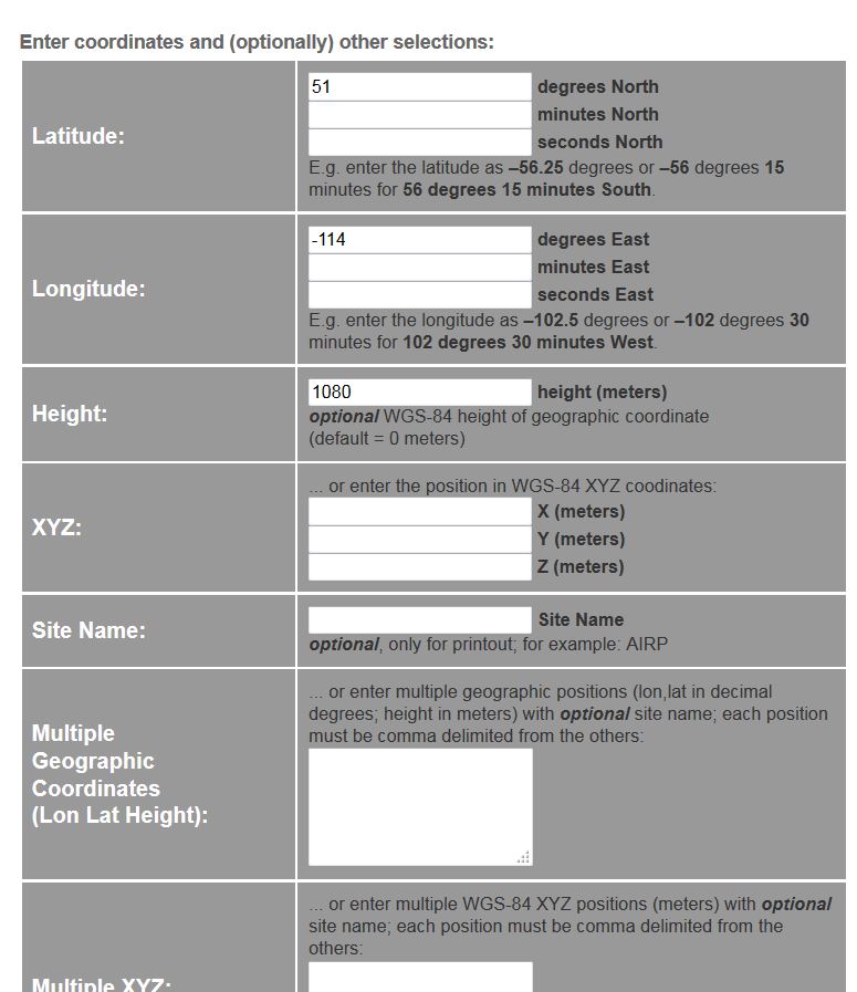
Morley arrived at his insight after years of studying the magnetic properties of rocks. After serving five years as an officer in the Canadian Navy during World War II, Morley took a job with a small geophysical company prospecting for magnetic iron ore in the north. His magnetometer – the best available at the time – was not much better than the tool Sir William Gilbert, who discovered the Earth is a magnet, had used 300 years earlier. Morley measured the intensity of magnetism by simply watching a needle balance horizontally on a knife edge. If he trudged across a magnetic vein embedded within the granite at his feet, the needle sometimes deflected further downwards. “This was high-tech at the time. It would take a whole day to collect a mile-long magnetic profile of data. This tedious work, combined with unbelievable clouds of mosquitoes in the Canadian Shield,” he said later. [2] Hiking all day across brutal terrain was the only way to capture a few magnetic data points in 1946. But a year later, his data collection would speed up a hundred-fold.

When Morley heard about the potential use of airplanes towing magnetometers on long cables, he vowed he would never go back into the bush with a hand-held device. The airborne tool had been perfected by Gulf Research and Development Corporation just before the Second World War. The oil company planned to use it to outline potential hydrocarbon basins, but loaned the equipment to the US Navy during the war as a search tool against enemy submarines. The war was over when Morley, by then working in the Canadian Shield and nursing mosquito bites, heard a talk about the airborne magnetometer. He realized he’d rather fly in a recycled navy warplane than spend five minutes trying to get a single point reading.

Gulf was headquartered in Pittsburgh; Morley was in Ontario. Getting across the Canadian-American border was a problem. According to historian Henry Frankel, Morley said, “I couldn’t get a job unless I had a visa, and I couldn’t get a visa unless I had a job. I actually sneaked across the border.” [3] Morley presented himself to Gulf, but they wouldn’t hire him as a researcher without a PhD. Instead, they referred him to a small independent contractor. Morley spent 1947 and 1948 as their party chief, flying an aeromagnetic survey in Venezuela and Colombia over the Llanos Basin, east of the Andes. It was the world’s first commercial aeromagnetic survey and Morley proved that a huge tract of land could be surveyed from the air by peering through thick inaccessible jungle and cloudy rain forest to assess mineral deposits and oil basins. Morley returned to Canada, determined to use aeromagnetic surveys to explore the vast Canadian Shield.

Morley in 1963

Morley in 1963

Back in Ontario, he realized that learning theoretical geophysics would be useful. Because of the war, his BSc had been truncated. Morley returned to the University of Toronto where Tuzo Wilson became his PhD supervisor. Tuzo Wilson was already legendary in both geology and geophysics. Canada’s first geophysicist, Wilson would later play a pivotal role in plate tectonics theory by solving a thorny problem with crustal motion along mid-oceanic ridges and for proposing that the Hawaiian islands came to life from a hotspot under the moving Pacific plate.

Wilson, in 1949, introduced Morley to the idea of continental drift. Although the great Wilson had not yet made up his own mind about the theory, Lawrence Morley became intrigued. He was even more captivated when, as part of his preparation for graduate research, he encountered a new paper on palaeomagnetism. Its author suggested that the magnetism of ancient rocks might offer evidence for continental drift. [4] If one could plot old magnetic pole positions, one could track the ancient movement of the continents. This was fifteen years before plate tectonics would enter mainstream geology. It was still a fringe science with many more detractors than supporters. Nevertheless, for his doctoral thesis, Morley pursued the remnant magnetism of the Precambrian Shield’s rocks. But the polar drift data he sought eluded him – geophysical equipment in 1950 was simply not accurate enough. Background noise and primitive equipment overwhelmed his efforts. “I could not get a constant direction. I couldn’t clean the samples enough to get a consistent direction,” he said. [5]  Morley’s effort to prove continental drift through remnant magnetism failed; nevertheless, his research was sound and he earned his doctorate.

GSC Magnetic Intensity NWT: tight circles could indicate diamond-rich kimberlite pipes

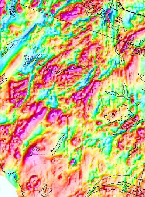
Magnetic Intensity of NWT: tight circles could indicate diamond-rich kimberlite pipes

In 1952, he became the first geophysicist to work for the Geological Survey of Canada. Most of his time was now spent planning and supervising government aeromagnetic surveys to encourage mineral exploration. Data collecting was contracted at a cost of $30 million dollars and took 17 years to complete. “The benefits of this survey to the mining industry in Canada have never been calculated, but they must be more than several billion dollars and are still going strong,” he wrote in his reminiscent article The Zebra Pattern. [6] It was this government data that inspired diamond prospecting in the Northwest Territories and led to ore discoveries from Newfoundland to the Yukon.

As an expert in magnetic properties of rocks, Lawrence Morley was drawn to Ron Mason’s zebra-pattern magnetism map of the Pacific Ocean. Morley, working at the Geological Survey of Canada, was the first to correctly interpret the alternating stripes as direct evidence of seafloor spreading. He called it his “Eureka Moment.” The stripes, he believed, were because new seafloor was being created by magma at oceanic rifts, and as it cooled into solid rock, the magnetic polarity of the moment was captured. Hence, the stripes. Morley was right. He tried to get his paper published in Nature, the prestigious British science journal, in February 1963. He penned a simple, non-analytic interpretation of Ron Mason’s zebra-striped map, but the journal and the geophysical community were not ready to entertain musings that linked magnetic anomalies to the spreading seafloor.

However, Morley had perfectly captured the solution. Independently, and just a few months later, the British team of Frederick Vine and Drummond Matthews came to the same conclusion. They were successfully published, in Nature, in September, 1963. It was unfortunate timing for Morley – and for Vine and Matthews, who likely didn’t know about the Canadian work. But the entire episode points to a fundamental problem with peer-reviewed publication. As Morley himself noted, “I knew that when a scientific paper is submitted to a journal, the editors choose reviewers who are experts on the topic being discussed. But the very expertise that makes them appropriate reviewers also generates a conflict of interest: they have a vested interest in the outcome of the debate.” [7] Morley’s reviewer, who remains anonymous, may have felt seafloor magnetic zebra stripes prove nothing, and may have been staunchly opposed to the concept of continental drift. Or he may have been aware of the research at Cambridge wanted those scientists to receive credit. Morley was told that Nature did not have room to print his short paper. Lawrence Morley quickly dispatched it to another research journal, which also rejected it. There, the anonymous reviewer scolded that although Morley’s idea was interesting, it was best discussed over martinis, rather than published in the Journal of Geophysical Research.

Perhaps the real problem was that Morley’s explanation of the zebra pattern was qualitative, not quantitative. The zebra map’s raw data were still classified, so Morley did not have the actual numerical values in hand, nor did he have other marine data that might have corroborated the Pacific magnetic set. At Cambridge, scientists had been gathering similar, albeit unclassified, data from the Indian Ocean and North Atlantic long before Frederick Vine became a grad student there, so the Matthews and Vine article had the university’s considerable quantitative material to draw upon for their analysis. Nevertheless, Dr Norman Watkins in 1974 wrote in Geology that Morley’s theory was “the most significant paper in earth sciences ever to be denied publication.” Instead, “Magnetic Anomalies over Oceanic Ridges” by Matthews and Vine was submitted to Nature (the same journal which had rejected Morley) in July and was published in September 1963. The Cambridge paper had numerical data which Morley’s work lacked, but the interpretation and results were the same. When it became apparent Lawrence Morley had previously tried to publish the same conclusion, he was also belatedly credited in the Morley-Vine-Matthews Hypothesis.

I have read a few misguided stories that claim Lawrence Morley was so bitter from the experience that he disappeared and was never heard from again. I guess that would be one way to end this piece. But instead of sinking into oblivion, Morley served as head of geophysics at the Canadian Geological Survey for the next 17 years – he stayed in earth science research for over 50 years. As founder of the Canadian Remote Sensing Society, he slowly shifted his focus from earth-bound geophysics to space-probing geophysics. Through that society, and later Natural Resources Canada, he pioneered the ground-breaking Radarsat system of satellite imaging as a way to monitor floods, fires, urban sprawl, sea ice changes, Russian Arctic invasions, and as an aid to mineral exploration.

Morley in 2008

Lawrence Morley,  in 2008

One of Lawrence Morley’s last public acts was a defiant stand against the conspired sale of the Canadian government’s advanced Radarsat-2 series of satellites (and the Canadarm) to foreign interests. Morley had been instrumental in the creation of Radarsat. He lamented the potential loss of a cutting-edge system that Canadian taxpayers spent billions of dollars developing. He was especially upset that the buyer would be American defense contractor Alliant Techsystems. Morley was 88 years old in 2008 when he went on a spirited speaking and letter-writing campaign, saying that the sale would be a blow to Canadian sovereignty. Others joined the cause, including Canada’s first astronaut, Marc Garneau, who was by then a member of parliament.

They won. Today, Canada still has a space agency, Radarsat satellites, and the Canadarm. Invoking the Canada Investment Act, it was the first time in 23 years that an impending sale was stopped by the federal government on the basis of “net benefit” to Canada. Jim Prentice, Industry Minister (and now Alberta’s premier) confirmed in a 2008 news conference that sovereignty questions over the transfer of Radarsat-2 technology were factors in halting the sale. Lawrence Morley was elated. The former Navy officer, geophysicist, space pioneer, and plate tectonics revolutionary was once again proven right.

**Much of the preceding was pilfered from my book. You can read more about this and other stories of geophysical discovery in The Mountain Mystery.

1. Morley, Lawrence (1963). Morley’s “Letter” from John Lear’s article, “Canada’s unappreciated role as scientific innovator,” Saturday Review (2 Sep 1967), p 47.
2. Morley, Lawrence (2001). “The Zebra Pattern,” Plate Tectonics: An Insider’s History of the Modern Theory of the Earth, edited by Naomi Oreskes. p 70. Westview Press, Cambridge, Massachusetts.
3. Frankel, Henry R. (1987). The Continental Drift Controversy: Evolution into Plate Tectonics, Vol 4, p 126. Cambridge University Press.
4. The paper that deeply influenced Morley’s thesis choice was John Graham’s 1949 monograph, “The Stability and Significance of Magnetism in Sedimentary Rocks.”
5. Frankel, Henry R. (1987). The Continental Drift Controversy: Evolution into Plate Tectonics, Vol 4, p 126. Cambridge University Press.
6. Morley, Lawrence (2001). “The Zebra Pattern,” Plate Tectonics: An Insider’s History of the Modern Theory of the Earth, edited by Naomi Oreskes. p 71. Westview Press, Cambridge, Massachusetts.
7. Morley, Lawrence (2001). “The Zebra Pattern,” Plate Tectonics: An Insider’s History of the Modern Theory of the Earth, edited by Naomi Oreskes. p 84. Westview Press, Cambridge, Massachusetts.

Posted in Biography, Geology, History, Plate Tectonics, Space, The Book | Tagged , , , , , , , | 1 Comment

200 Years of Volcanic Legacy

How Tambora changed our planet.

How Tambora changed our planet.

I am rather pleased when my favourite non-science journal explains a bit of science – and gets it right! I’ve been reading The Economist ever since I discovered the world, and the magazine has seldom let me down. Here is a great little video from The Economist’s science and nature folks. It shows how volcanoes rule. Or at least can briefly interrupt the climate’s intentions. Their model is the 1815 Indonesian Tambora eruption which indirectly inspired Mary Shelley to write Frankenstein and Joseph Smith’s family to leave freezing Vermont’s Year without a Summer and settle in New York where young Smith soon found the golden plates that started the Latter Day Saints on their march to salvation and Utah.

Today marks the 200th anniversary of the April 10, 1815 Tambora explosion that killed hundreds of thousands. Except for Young Frankenstein and some nice buildings in Salt Lake City, there really isn’t much left to remind us of that infamous volcano. But if you’d like to know more about Tambora, I wrote a blog a few months ago which details this connection. Meanwhile,  here’s The Economist video.

Posted in Climate, Culture, Geology | Tagged , , , | Leave a comment

Trumpeting the Quake

Why is this elephant running?

Why is this elephant running?

Earthquake prediction may run off in a new direction. We’ve tried electronics attached to seismic detectors (and made some progress), but there may be a new ally in the battle to give a warning before the next big one knocks you off your feet. The way things work now, geophysicists can’t tell you when an earthquake will strike – we can’t predict which hour, day, month, nor even year. We don’t know. But some people think that perhaps the elephants know.

The animal stories about quakes border on pseudo-science.  Elephants were much in the news after the 2004 Boxing Day quake and tsunami in southeast Asia. Eyewitnesses claim that very few animals were killed in the carnage that took hundreds of thousands of human lives. Flamingos and bats flew to high ground, dogs and cats fled together from seaside villages, and elephants screamed, then trumpeted as they ran, heralding the coming doom. Reports asserted that elephants were particularly keen to escape the lowlands during the moments before the tsunami. Ravi Corea, president of the Sri Lanka Wildlife Conservation Society said he was surprised by the lack of animal carcasses (other than two water buffaloes) following the tsunami, though about 50 humans died on a beach in his area. About an hour before the tidal wave hit, people noticed three elephants running away from the beach, said Corea. Another person claimed that his family dogs refused to go for their daily run along the water’s edge shortly before the tsunami struck. Three elephants running, two dogs hiding, and a flamingo flying uphill does not prove that animals have extra senses attuned to impending disaster. However, for centuries, folk legends have been telling us that animals know when woe is nigh.

Barbar readingThe United States Geological Survey (USGS) decided to investigate the wisdom and predictive powers of animals. Is there real proof that creatures detect earthquakes and tsunamis before they occur? Or is it a case of hindsight on the part of observers? Humans have a brilliant tendency to recreate history and fill in gaps as part of our hard-wired system of explaining the world to ourselves. We are also excellent at extrapolating a few examples and turning them into a complete world-view. We are particularly susceptible to confirmation bias, our tendency to find explanations for odd phenomena that agree with our ideas of how the universe should work. (For example, a person may recall that just before a tremor, the cat was hissing. Perhaps it was. But that feeble old cat hisses thirty times a day, the tremor happened just once. Retrospective explaining that confirms a prior notion is confirmation bias.) Is this what is happening after a catastrophe when people report unusual activity of pets and wildlife that they noticed? The USGS wanted to know.

housequakeTentatively, the USGS scientists concluded that a geophysicist-elephant’s skill at predicting earthquakes and tsunamis is not convincing. In their paper, Animals and Earthquakes, the investigators suggest that “We can easily explain the cause of unusual animal behavior seconds before humans feel an earthquake. Very few humans notice the smaller P wave that travels the fastest from the earthquake source and arrives before the larger S wave. But many animals with more keen senses are able to feel the P wave seconds before the S wave arrives.” Elephants are known to hear low frequency sounds (the rumbles of distant tribe members, the roar of an incoming tsunami) even when the source is 30 kilometres away. This might have something to do with those huge ears and big flat feet. But, as the USGS paper says, there might be senses other than auditory involved. Could animals feel the ground tilt, could they sense electric or magnetic atmospheric changes before an earthquake? The authors inform us that we don’t even know if electromagnetic field changes are involved and suggest that this is an area ripe for scientific inquiry.

The USGS paper cites three sources, all relatively old, dating from 1985, 1988, and 2000. The sources, especially the 1988 paper by UCLA’s Rand Schaal, looked for statistical correlation with commonly reported animal phenomena. In particular, Schaal reviewed the number of missing dogs reported in the local papers. (Schaal writes, “For a dozen years a theory has been advanced in the south San Francisco Bay area that when an extraordinarily large number of dogs and cats are reported in the “Lost and Found” section of the San Jose Mercury News, the probability of an earthquake striking the area increases significantly.”) Schaal’s statistics show that there were 62 large quakes during the study period but only 9 correlated with runaway dogs while 16 earthquakes were preceded by stay-at-home pooch activity. The paper’s bottom line: There is no relationship between missing dogs and impending quakes. Furthermore, the number of missing dogs “is not proportional to the quantity or magnitudes of quakes,” wrote Schaal.

Howling wolfOK, so dogs don’t make howling great seismologists. But there is still the nasty business of a story that has lasted at least 2400 years, a folk legend that tells us to mind our dogs, cats, and toads because they know when to run. For example, when the Greek city of Helike was flattened by a quake and tsunami in 373 BC, dogs ran three kilometres (2 miles) to Keryneia, a hill town about 300 metres (1000 ft) higher than coastal Helike. The destruction was preceded by flashes of bright light. Religious folks at the time said that the catastrophe was attributed to the vengeance of Poseidon (god of oceans, horses, and earthquakes) because the inhabitants of Helike had refused to give their statue of Poseidon to the Ionian colonists in Asia. Maybe they are right – I wasn’t there when it happened and the locals of the time swear it’s true. But I digress. And I glossed over the flashes of bright light. Maybe they caused the dogs to run.

auroraAbout those flashes of bright light. In second-year geophysics, I was taught something called the piezoelectric effect. If you squeeze particular minerals, ceramics, bones, money, proteins, or rocks hard enough, a bit of electricity is released. We are talking about enormous masses of rock and enormous earthquake pressures, so the amount of piezo- electricity could be significant. When visible, scientists call these discharges Earthquake Light. The flashes are reported to have shapes similar to those of polar auroras and are usually a white to bluish hue. The glow is reported to be visible for several seconds, sometimes even minutes. Earthquake Light has been reported in Hawaii, New Zealand, California, Japan, and ancient Greece – it seems unrelated to culture or geography, but is centered around earthquakes and has been seen before, during, and after quakes. But not every earthquake is accompanied by a glow show. However, it has been speculated that every earthquake may have some piezoelectric effect going on. If the right equipment is in place to monitor a fault zone, it may be possible to detect the buildup of rock stress and predict earthquakes.

One would think that the piezoelectric effect could become a potent tool for forecasting imminent earthquakes. There must be dozens of geophysicists investigating this. If there are, they are keeping pretty quiet about their work.

But one scientist willing to talk about this quake link is Friedemann Freund. Freund’s research into the way rocks under stress can release hundreds of thousand amperes may lead to a real breakthrough in earthquake forecasting. His work uses the subtle electromagnetic signals generated when stresses build up along fault zones. Freund, working with two post-doctorate researchers at NASA and later with a group of students, showed that air molecules become significantly ionized near rocks that are stressed. They even observed tiny sparks flying off the edges of the rocks – likely a scaled-down version of the bright light phenomenon observed since Grecian times in Helike.

This led Freund, working with Thomas Bleier at Stellar Solutions, to monitor the output of dozens of ultralow frequency sensors set along fault zones in California, Peru, Greece, Sumatra, and Taiwan. They say that they have found significant increases in ionization whenever there has been a moderate to large earthquake nearby.

“Changes in Animal Activity Prior to a Major (M=7) Earthquake in the Peruvian Andes”, appearing in last month’s Physics and Chemistry of the Earth, and written by Friedemann Freund, Rachel Grant, and Jean Pierre Raulin, correlates animal behaviour in Peru to a major 2011 quake. In their paper, the researchers

“…present records of changes in the abundance of mammals and birds obtained over a 30 day period by motion-triggered cameras at the Yanachaga National Park, Peru, prior to the 2011 magnitude 7.0 Contamana earthquake. In addition we report on ionospheric perturbations derived from night-time very low frequency (VLF) phase data along a propagation paths passing over the epicentral region. Animal activity declined significantly over a 3-week period prior to the earthquake compared to periods of low seismic activity.”

Freund believes that evidence indicates that ultralow frequency electromagnetic waves in the environment prior to an earthquake can have effects on animal behavior. Freund et.al. propose that the “multitude of reported pre-earthquake phenomena may arise from a single underlying physical process: the stress-activation of highly mobile electronic charge carriers in the Earth’s crust and their flow to the Earth’s surface… [These are] known to be aversive to animals.”

Freund is studying the potential link and is looking for ways of using pre-quake radiation to predict earthquakes. His key investigation is to determine if we can use the signals produced during the build-up of quakes and detect them at the Earth’s surface. Freund says his hope is that we will reach a point where we can forewarn of impending tremors in a way similar to severe weather alerts – we can not predict any particular lightning strike, but we can usually give warnings that extreme thunderstorm damage is likely in a region within a few hours. Such a warning may take the form of “Stresses at a particular fault seem to be building up deep in the earth’s crust and there is an increased chance of an earthquake within the next few days.” This would be a great improvement over our current predictive abilities which simply give a probability in the range of years. Parts of California’s San Andreas Fault, for example, have a 97% probability of being visited by a 6.7 or greater magnitude earthquake within the next 30 years. This, of course, is extremely helpful for construction plans and safety guidelines. But it is not the sort of information that will send you off on a two-week visit to Calgary or London.

What about the animals? It may be possible that dogs and cats and birds and lizards sense the buildup of electricity due to the overwhelming rock stress preceding an earthquake. But what would they do with such information? Is there an evolutionary advantage to fleeing earthquakes? Not likely. Devastating earthquakes may occur every elephant headcentury or two along an active fault zone. Even then, small surface animals would not likely be hurt. Most damage and death is structure-related. Humans fare poorly during earthquakes because our homes collapse. Burrowing animals may be similarly disadvantaged, but most surface-dwelling animals would simply be annoyed – not killed – during an earthquake. There would not be an inherited genetic predisposition that alerts animals to a brewing quake, nor would most animals have first-hand experience or handed-down legends to inform them of the best reaction to an earthquake.

If there is any animal-quake relationship, it may be due to the annoyance of the increasing electromagnetic field which some animals may find irritating enough to cause a quick jaunt towards anyplace away from the snap and crackle of atmospheric static. Relating charges to elevated earthquake threats makes an interesting hypothesis, but will take time to prove. However, such a study has life-saving potential and is worth the effort.

Posted in Geology | Tagged , , , , , , | Leave a comment